Dobročkovice
Dobročkovice | |
|---|---|
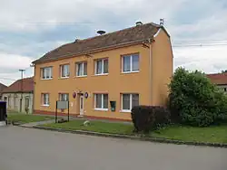 Municipal office | |
 Flag  Coat of arms | |
 Dobročkovice Location in the Czech Republic | |
| Coordinates: 49°9′47″N 17°6′32″E / 49.16306°N 17.10889°E | |
| Country | |
| Region | South Moravian |
| District | Vyškov |
| First mentioned | 1348 |
| Area | |
• Total | 5.03 km2 (1.94 sq mi) |
| Elevation | 292 m (958 ft) |
| Population (2025-01-01)[1] | |
• Total | 232 |
| • Density | 46/km2 (120/sq mi) |
| Time zone | UTC+1 (CET) |
| • Summer (DST) | UTC+2 (CEST) |
| Postal code | 683 33 |
| Website | dobrockovice |
Dobročkovice is a municipality and village in Vyškov District in the South Moravian Region of the Czech Republic. It has about 200 inhabitants.
Dobročkovice lies approximately 15 kilometres (9 mi) south-east of Vyškov, 37 km (23 mi) east of Brno, and 220 km (140 mi) south-east of Prague.
Demographics
| Year | Pop. | ±% |
|---|---|---|
| 1869 | 470 | — |
| 1880 | 519 | +10.4% |
| 1890 | 587 | +13.1% |
| 1900 | 529 | −9.9% |
| 1910 | 530 | +0.2% |
| 1921 | 554 | +4.5% |
| 1930 | 549 | −0.9% |
| 1950 | 427 | −22.2% |
| 1961 | 426 | −0.2% |
| 1970 | 351 | −17.6% |
| 1980 | 300 | −14.5% |
| 1991 | 222 | −26.0% |
| 2001 | 210 | −5.4% |
| 2011 | 196 | −6.7% |
| 2021 | 231 | +17.9% |
| Source: Censuses[2][3] | ||
References
- ^ "Population of Municipalities – 1 January 2025". Czech Statistical Office. 2025-05-16.
- ^ "Historický lexikon obcí České republiky 1869–2011" (in Czech). Czech Statistical Office. 2015-12-21.
- ^ "Population Census 2021: Population by sex". Public Database. Czech Statistical Office. 2021-03-27.
External links
Wikimedia Commons has media related to Dobročkovice.