Rybníček (Vyškov District)
Rybníček | |
|---|---|
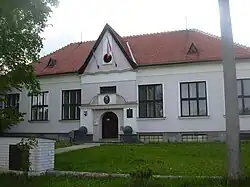 Municipal office | |
 Flag .svg.png) Coat of arms | |
 Rybníček Location in the Czech Republic | |
| Coordinates: 49°16′26″N 17°4′26″E / 49.27389°N 17.07389°E | |
| Country | |
| Region | South Moravian |
| District | Vyškov |
| First mentioned | 1373 |
| Area | |
• Total | 2.10 km2 (0.81 sq mi) |
| Elevation | 236 m (774 ft) |
| Population (2025-01-01)[1] | |
• Total | 259 |
| • Density | 120/km2 (320/sq mi) |
| Time zone | UTC+1 (CET) |
| • Summer (DST) | UTC+2 (CEST) |
| Postal code | 682 01 |
| Website | www |
Rybníček is a municipality and village in Vyškov District in the South Moravian Region of the Czech Republic. It has about 300 inhabitants.
Rybníček lies approximately 6 kilometres (4 mi) east of Vyškov, 35 km (22 mi) east of Brno, and 212 km (132 mi) south-east of Prague.
Demographics
| Year | Pop. | ±% |
|---|---|---|
| 1869 | 228 | — |
| 1880 | 221 | −3.1% |
| 1890 | 225 | +1.8% |
| 1900 | 218 | −3.1% |
| 1910 | 246 | +12.8% |
| 1921 | 242 | −1.6% |
| 1930 | 241 | −0.4% |
| 1950 | 218 | −9.5% |
| 1961 | 259 | +18.8% |
| 1970 | 279 | +7.7% |
| 1980 | 266 | −4.7% |
| 1991 | 298 | +12.0% |
| 2001 | 292 | −2.0% |
| 2011 | 258 | −11.6% |
| 2021 | 266 | +3.1% |
| Source: Censuses[2][3] | ||
References
- ^ "Population of Municipalities – 1 January 2025". Czech Statistical Office. 2025-05-16.
- ^ "Historický lexikon obcí České republiky 1869–2011" (in Czech). Czech Statistical Office. 2015-12-21.
- ^ "Population Census 2021: Population by sex". Public Database. Czech Statistical Office. 2021-03-27.
External links
Wikimedia Commons has media related to Rybníček (Vyškov District).