Dunbar (CDP), Wisconsin
Dunbar, Wisconsin | |
|---|---|
Census-designated place | |
 Looking west in downtown Dunbar on US8 | |
 Dunbar, Wisconsin | |
| Coordinates: 45°39′03″N 88°10′17″W / 45.65083°N 88.17139°W | |
| Country | United States |
| State | Wisconsin |
| County | Marinette |
| Area | |
• Total | 1.066 sq mi (2.76 km2) |
| • Land | 1.064 sq mi (2.76 km2) |
| • Water | 0.002 sq mi (0.005 km2) |
| Elevation | 1,306 ft (398 m) |
| Population | |
• Total | 61 |
| • Density | 57/sq mi (22/km2) |
| Time zone | UTC-6 (Central (CST)) |
| • Summer (DST) | UTC-5 (CDT) |
| ZIP code | 54119 |
| Area codes | 715 & 534 |
| GNIS feature ID | 1564171[2] |
Dunbar is a census-designated place in the town of Dunbar, Marinette County, Wisconsin, United States. Dunbar is located on U.S. Route 8 12 miles (19 km) southwest of Niagara. Dunbar has a post office with ZIP code 54119.[3] As of the 2020 census, its population is 61.
| Census | Pop. | Note | %± |
|---|---|---|---|
| 2010 | 50 | — | |
| 2020 | 61 | 22.0% | |
| U.S. Decennial Census[4] | |||
Images
-
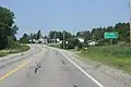 Sign on US8
 -
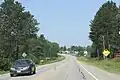 Panorama
 -
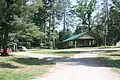 Veteran's Park
 -
 Welcome sign
See also
References
- ^ "Census Bureau profile: Dunbar CDP, Wisconsin". United States Census Bureau. May 2023. Retrieved April 1, 2025.
- ^ U.S. Geological Survey Geographic Names Information System: Dunbar (CDP), Wisconsin
- ^ ZIP Code Lookup
- ^ "Decennial Census by Decade". United States Census Bureau. Retrieved April 1, 2025.
External links
![]() Media related to Dunbar (CDP), Wisconsin at Wikimedia Commons
Media related to Dunbar (CDP), Wisconsin at Wikimedia Commons
Municipalities and communities of Marinette County, Wisconsin, United States | ||
|---|---|---|
| Cities |  | |
| Villages | ||
| Towns | ||
| CDPs | ||
| Unincorporated communities | ||
| Footnotes | ‡This populated place also has portions in an adjacent county or counties | |