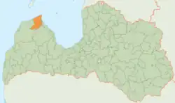
Dundaga Municipality
Dundaga Municipality
Dundagas novads | |
|---|---|
Former municipality | |
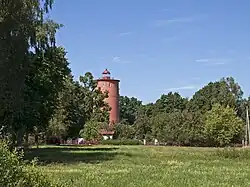 Slītere Lighthouse | |
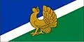 Flag 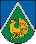 Coat of arms | |
 | |
| Country | |
| Formed | 2009 |
| Centre | Dundaga |
| Government | |
| • Council Chair | vacant |
| Area | |
• Total | 676.35 km2 (261.14 sq mi) |
| • Land | 667.74 km2 (257.82 sq mi) |
| • Water | 8.61 km2 (3.32 sq mi) |
| Population (2021)[2] | |
• Total | 3,487 |
| • Density | 5.2/km2 (13/sq mi) |
| Website | www |
Dundaga Municipality (Latvian: Dundagas novads, Livonian: Dūoņig mōgõn)[3] is a former municipality in Courland, Latvia. The municipality was formed in 2009 by merging Dundaga parish and Kolka parish, the administrative centre being Dundaga. As of 2020, the population was 3,571.[4]
On 1 July 2021, Dundaga Municipality ceased to exist and its territory was merged into Talsi Municipality.[5]
Notable sites
See also
References
- ^ Central Statistical Bureau of Latvia https://data.stat.gov.lv/pxweb/lv/OSP_PUB/START__ENV__DR__DRT/DRT010/. Retrieved 25 February 2021.
{{cite web}}: Missing or empty|title=(help) - ^ Central Statistical Bureau of Latvia https://data.stat.gov.lv/pxweb/lv/OSP_PUB/START__POP__IR__IRS/IRD060/. Retrieved 15 June 2021.
{{cite web}}: Missing or empty|title=(help) - ^ "Dundagas novads piedalīsies «Balttour» izstādē" [Dundaga Municipality will participate in the BaltTour expo]. www.dundaga.lv. 2019-01-25. Retrieved 2023-07-20.
- ^ "ISG020. Population number and its change by statistical region, city, town, 21 development centres and county". Central Statistical Bureau of Latvia. 2020-01-01. Retrieved 2021-02-12.
- ^ "Administratīvo teritoriju un apdzīvoto vietu likums". LIKUMI.LV (in Latvian). Retrieved 2024-08-08.
57°31′N 22°21′E / 57.517°N 22.350°E