Étalante
Étalante | |
|---|---|
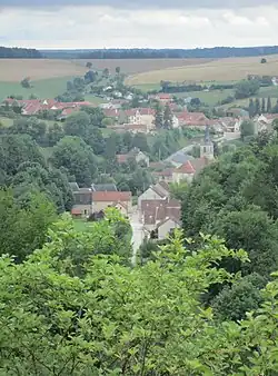 A general view of Étalante | |
.svg.png) Coat of arms | |
Location of Étalante | |
 Étalante  Étalante | |
| Coordinates: 47°38′32″N 4°45′48″E / 47.6422°N 4.7633°E | |
| Country | France |
| Region | Bourgogne-Franche-Comté |
| Department | Côte-d'Or |
| Arrondissement | Montbard |
| Canton | Châtillon-sur-Seine |
| Intercommunality | Pays Châtillonnais |
| Government | |
| • Mayor (2020–2026) | Eric Dudouet[1] |
Area 1 | 39.15 km2 (15.12 sq mi) |
| Population (2022)[2] | 128 |
| • Density | 3.3/km2 (8.5/sq mi) |
| Time zone | UTC+01:00 (CET) |
| • Summer (DST) | UTC+02:00 (CEST) |
| INSEE/Postal code | 21253 /21510 |
| Elevation | 329–477 m (1,079–1,565 ft) (avg. 442 m or 1,450 ft) |
| 1 French Land Register data, which excludes lakes, ponds, glaciers > 1 km2 (0.386 sq mi or 247 acres) and river estuaries. | |
Étalante (French pronunciation: [etalɑ̃t]) is a commune in the Côte-d'Or department in eastern France.
Population
| Year | Pop. | ±% |
|---|---|---|
| 1962 | 288 | — |
| 1968 | 299 | +3.8% |
| 1975 | 238 | −20.4% |
| 1982 | 195 | −18.1% |
| 1990 | 185 | −5.1% |
| 1999 | 144 | −22.2% |
| 2008 | 130 | −9.7% |
See also
References
- ^ "Répertoire national des élus: les maires". data.gouv.fr, Plateforme ouverte des données publiques françaises (in French). 2 December 2020.
- ^ "Populations de référence 2022" (in French). The National Institute of Statistics and Economic Studies. 19 December 2024.
Wikimedia Commons has media related to Étalante.