Ettringen, Bavaria
Ettringen | |
|---|---|
 Main street and the parish church | |
_COA.svg.png) Coat of arms | |
Location of Ettringen within Unterallgäu district 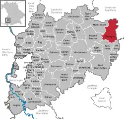 | |
 Ettringen  Ettringen | |
| Coordinates: 48°6′N 10°39′E / 48.100°N 10.650°E | |
| Country | Germany |
| State | Bavaria |
| Admin. region | Schwaben |
| District | Unterallgäu |
| Government | |
| • Mayor (2020–26) | Robert Sturm[1] |
| Area | |
• Total | 41.5 km2 (16.0 sq mi) |
| Elevation | 581 m (1,906 ft) |
| Population (2024-12-31)[2] | |
• Total | 3,483 |
| • Density | 84/km2 (220/sq mi) |
| Time zone | UTC+01:00 (CET) |
| • Summer (DST) | UTC+02:00 (CEST) |
| Postal codes | 86833 |
| Dialling codes | 08249 |
| Vehicle registration | MN |
| Website | www.ettringen.de |
Ettringen (German pronunciation: [ˈɛtʁɪŋən]) is a municipality in the district of Unterallgäu in Bavaria, Germany.
References
- ^ Liste der ersten Bürgermeister/Oberbürgermeister in kreisangehörigen Gemeinden, Bayerisches Landesamt für Statistik, 15 July 2021.
- ^ "Gemeinden, Kreise und Regierungsbezirke in Bayern, Einwohnerzahlen am 31. Dezember 2024; Basis Zensus 2022" [Municipalities, counties, and administrative districts in Bavaria; Based on the 2022 Census] (CSV) (in German). Bayerisches Landesamt für Statistik.