Hůry
Hůry | |
|---|---|
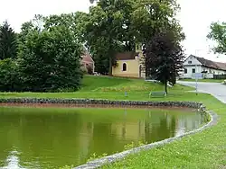 Chapel of Saint Florian in the centre of Hůry | |
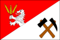 Flag 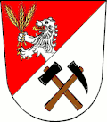 Coat of arms | |
 Hůry Location in the Czech Republic | |
| Coordinates: 49°0′24″N 14°32′28″E / 49.00667°N 14.54111°E | |
| Country | |
| Region | South Bohemian |
| District | České Budějovice |
| First mentioned | 1378 |
| Area | |
• Total | 5.34 km2 (2.06 sq mi) |
| Elevation | 467 m (1,532 ft) |
| Population (2025-01-01)[1] | |
• Total | 610 |
| • Density | 110/km2 (300/sq mi) |
| Time zone | UTC+1 (CET) |
| • Summer (DST) | UTC+2 (CEST) |
| Postal code | 373 71 |
| Website | www |
Hůry is a municipality and village in České Budějovice District in the South Bohemian Region of the Czech Republic. It has about 600 inhabitants.
Hůry lies approximately 6 kilometres (4 mi) north-east of České Budějovice and 121 km (75 mi) south of Prague.
Demographics
| Year | Pop. | ±% |
|---|---|---|
| 1869 | 401 | — |
| 1880 | 418 | +4.2% |
| 1890 | 450 | +7.7% |
| 1900 | 476 | +5.8% |
| 1910 | 523 | +9.9% |
| 1921 | 489 | −6.5% |
| 1930 | 528 | +8.0% |
| 1950 | 332 | −37.1% |
| 1961 | 334 | +0.6% |
| 1970 | 312 | −6.6% |
| 1980 | 368 | +17.9% |
| 1991 | 388 | +5.4% |
| 2001 | 418 | +7.7% |
| 2011 | 559 | +33.7% |
| 2021 | 610 | +9.1% |
| Source: Censuses[2][3] | ||
References
- ^ "Population of Municipalities – 1 January 2025". Czech Statistical Office. 2025-05-16.
- ^ "Historický lexikon obcí České republiky 1869–2011" (in Czech). Czech Statistical Office. 2015-12-21.
- ^ "Population Census 2021: Population by sex". Public Database. Czech Statistical Office. 2021-03-27.
External links
Wikimedia Commons has media related to Hůry.