Heřmanice u Oder
Heřmanice u Oder | |
|---|---|
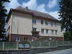 Municipal office | |
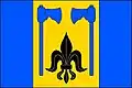 Flag 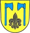 Coat of arms | |
 Heřmanice u Oder Location in the Czech Republic | |
| Coordinates: 49°42′49″N 17°48′19″E / 49.71361°N 17.80528°E | |
| Country | |
| Region | Moravian-Silesian |
| District | Nový Jičín |
| First mentioned | 1374 |
| Area | |
• Total | 11.95 km2 (4.61 sq mi) |
| Elevation | 486 m (1,594 ft) |
| Population (2025-01-01)[1] | |
• Total | 359 |
| • Density | 30/km2 (78/sq mi) |
| Time zone | UTC+1 (CET) |
| • Summer (DST) | UTC+2 (CEST) |
| Postal code | 742 35 |
| Website | www |
Heřmanice u Oder (German: Gross Hermsdorf) is a municipality and village in Nový Jičín District in the Moravian-Silesian Region of the Czech Republic. It has about 400 inhabitants.
Administrative division
Heřmanice u Oder consists of two municipal parts (in brackets population according to the 2021 census):[2]
- Heřmanice u Oder (295)
- Véska (60)
Demographics
| Year | Pop. | ±% |
|---|---|---|
| 1869 | 635 | — |
| 1880 | 655 | +3.1% |
| 1890 | 604 | −7.8% |
| 1900 | 549 | −9.1% |
| 1910 | 542 | −1.3% |
| 1921 | 509 | −6.1% |
| 1930 | 524 | +2.9% |
| 1950 | 364 | −30.5% |
| 1961 | 387 | +6.3% |
| 1970 | 358 | −7.5% |
| 1980 | 353 | −1.4% |
| 1991 | 318 | −9.9% |
| 2001 | 339 | +6.6% |
| 2011 | 316 | −6.8% |
| 2021 | 355 | +12.3% |
| Source: Censuses[3][4] | ||
References
- ^ "Population of Municipalities – 1 January 2025". Czech Statistical Office. 2025-05-16.
- ^ "Public Census 2021 – basic data". Public Database (in Czech). Czech Statistical Office. 2022.
- ^ "Historický lexikon obcí České republiky 1869–2011" (in Czech). Czech Statistical Office. 2015-12-21.
- ^ "Population Census 2021: Population by sex". Public Database. Czech Statistical Office. 2021-03-27.
External links
Wikimedia Commons has media related to Heřmanice u Oder.