Hirschbach im Mühlkreis
Hirschbach im Mühlkreis | |
|---|---|
 | |
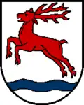 Coat of arms | |
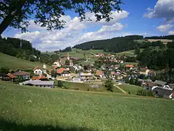
 Hirschbach im Mühlkreis Location within Austria | |
| Coordinates: 48°29′19″N 14°24′44″E / 48.48861°N 14.41222°E | |
| Country | Austria |
| State | Upper Austria |
| District | Freistadt |
| Government | |
| • Mayor | Stefan Wiesinger (ÖVP) |
| Area | |
• Total | 23.67 km2 (9.14 sq mi) |
| Elevation | 640 m (2,100 ft) |
| Population (2018-01-01)[2] | |
• Total | 1,194 |
| • Density | 50/km2 (130/sq mi) |
| Time zone | UTC+1 (CET) |
| • Summer (DST) | UTC+2 (CEST) |
| Postal code | 4242 |
| Area code | 07948 |
| Vehicle registration | FR |
| Website | www.hirschbach.at |
Hirschbach im Mühlkreis is a municipality in the district of Freistadt in the Austrian state of Upper Austria.
Population
| Year | Pop. | ±% |
|---|---|---|
| 1869 | 1,146 | — |
| 1880 | 1,119 | −2.4% |
| 1890 | 1,079 | −3.6% |
| 1900 | 1,085 | +0.6% |
| 1910 | 1,190 | +9.7% |
| 1923 | 1,188 | −0.2% |
| 1934 | 1,110 | −6.6% |
| 1939 | 1,056 | −4.9% |
| 1951 | 1,092 | +3.4% |
| 1961 | 1,163 | +6.5% |
| 1971 | 1,186 | +2.0% |
| 1981 | 1,152 | −2.9% |
| 1991 | 1,162 | +0.9% |
| 2001 | 1,186 | +2.1% |
References
- ^ "Dauersiedlungsraum der Gemeinden Politischen Bezirke und Bundesländer - Gebietsstand 1.1.2018". Statistics Austria. Retrieved 10 March 2019.
- ^ "Einwohnerzahl 1.1.2018 nach Gemeinden mit Status, Gebietsstand 1.1.2018". Statistics Austria. Retrieved 9 March 2019.
Wikimedia Commons has media related to Hirschbach im Mühlkreis.