Small Adzhalyk Estuary
| Small Adzhalyk Estuary | |
|---|---|
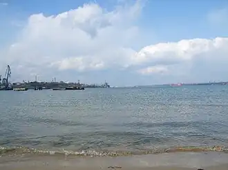 View to marine part of the estuary | |
 Small Adzhalyk Estuary | |
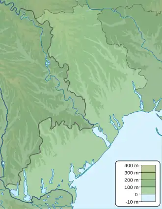
| Location | Black Sea |
| Coordinates | 46°37′25″N 31°01′09″E / 46.62361°N 31.01917°E |
| River sources | Malyi Adzhalyk |
| Ocean/sea sources | Atlantic Ocean |
| Basin countries | Ukraine |
| Max. length | 7.3 km (4.5 mi) |
| Max. width | 1.2 km (0.75 mi) |
| Surface area | 5.8 km2 (2.2 sq mi) |
| Average depth | 7.7 m (25 ft) |
| Max. depth | 14.5 m (48 ft) |
| Water volume | 44×106 m3 (1.6×10⁹ cu ft) |
| Salinity | 10-18 ‰ |
| Settlements | Pivdenne |
The Small Adzhalyk Estuary or Hryhorivsky Estuary [a] is a brackish water area in southern Ukraine, located 30 kilometres (19 mi) north-east of Odesa. In the lower part (left bank) of the estuary, the Pivdennyi Port is located there. The estuary is connected with the sea by the navigation canal 3 km length and 14 m depth. The length of the estuary is about 12 km, width from 300 m in upper part to 1.3 km in lower part.
Notes and references
- Starushenko L.I., Bushuyev S.G. (2001) Prichernomorskiye limany Odeschiny i ih rybohoziaystvennoye znacheniye. Astroprint, Odesa, 151 pp. (in Russian)
- North-western Black Sea: biology and ecology, Eds.: Y.P. Zaitsev, B.G. Aleksandrov, G.G. Minicheva, Naukova Dumka, Kyiv, 2006, 701 pp.
See also
Wikimedia Commons has media related to Small Adzhalyk Estuary.