Jefferson Township, Pulaski County, Indiana
Jefferson Township | |
|---|---|
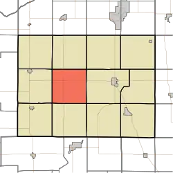 Location in Pulaski County | |
| Coordinates: 41°02′35″N 86°45′44″W / 41.04306°N 86.76222°W | |
| Country | |
| State | |
| County | Pulaski |
| Government | |
| • Type | Indiana township |
| Area | |
• Total | 36.4 sq mi (94 km2) |
| • Land | 36.4 sq mi (94 km2) |
| • Water | 0 sq mi (0 km2) 0% |
| Elevation | 696 ft (212 m) |
| Population (2020) | |
• Total | 490 |
| • Density | 13/sq mi (5.2/km2) |
| ZIP codes | 46996, 47946, 47957 |
| GNIS feature ID | 453496 |
Jefferson Township is one of twelve townships in Pulaski County, Indiana, United States. As of the 2020 census, its population was 490 and it contained 228 housing units.[1]
Jefferson Township was organized in 1851, and named after Thomas Jefferson, third President of the United States.[2]
| Census | Pop. | Note | %± |
|---|---|---|---|
| 1890 | 475 | — | |
| 1900 | 847 | 78.3% | |
| 1910 | 669 | −21.0% | |
| 1920 | 583 | −12.9% | |
| 1930 | 471 | −19.2% | |
| 1940 | 583 | 23.8% | |
| 1950 | 535 | −8.2% | |
| 1960 | 560 | 4.7% | |
| 1970 | 491 | −12.3% | |
| 1980 | 482 | −1.8% | |
| 1990 | 414 | −14.1% | |
| 2000 | 546 | 31.9% | |
| 2010 | 545 | −0.2% | |
| 2020 | 490 | −10.1% | |
| Source: US Decennial Census[3] | |||
Geography
According to the 2010 census, the township has a total area of 36.4 square miles (94 km2), all land.[4]
Adjacent townships
- Rich Grove Township (north)
- Franklin Township (northeast)
- Monroe Township (east)
- Indian Creek Township (southeast)
- Beaver Township (south)
- Salem Township (southwest)
- White Post Township (west)
- Cass Township (northwest)
Cemeteries
The township contains these three cemeteries: Burroughs, Idle and Koster.
Major highways
Education
- Eastern Pulaski Community School Corporation
- West Central School Corporation
Jefferson Township residents may obtain a free library card from the Pulaski County Public Library in Winamac.[5]
Political districts
- Indiana's 2nd congressional district
- State House District 20
- State Senate District 18
References
- United States Census Bureau 2008 TIGER/Line Shapefiles
- United States Board on Geographic Names (GNIS)
- IndianaMap
- ^ "Explore Census Data". data.census.gov. Retrieved April 14, 2024.
- ^ Counties of White and Pulaski, Indiana: Historical and Biographical. F.A. Battey & Company. 1883. p. 622.
- ^ "Township Census Counts: STATS Indiana".
- ^ "Population, Housing Units, Area, and Density: 2010 - County -- County Subdivision and Place -- 2010 Census Summary File 1". United States Census. Archived from the original on February 12, 2020. Retrieved May 10, 2013.
- ^ "The Library District". Pulaski County Public Library. Retrieved March 14, 2018.
External links
Places adjacent to Jefferson Township, Pulaski County, Indiana | |
|---|---|
Municipalities and communities of Pulaski County, Indiana, United States | ||
|---|---|---|
| Towns |  | |
| Townships | ||
| CDPs | ||
| Other communities | ||
| Footnotes | ‡This populated place also has portions in an adjacent county or counties | |