Salem Township, Pulaski County, Indiana
Salem Township | |
|---|---|
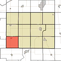 Location in Pulaski County | |
| Coordinates: 40°57′26″N 86°52′32″W / 40.95722°N 86.87556°W | |
| Country | |
| State | |
| County | Pulaski |
| Government | |
| • Type | Indiana township |
| Area | |
• Total | 35.79 sq mi (92.7 km2) |
| • Land | 35.79 sq mi (92.7 km2) |
| • Water | 0 sq mi (0 km2) 0% |
| Elevation | 673 ft (205 m) |
| Population (2020) | |
• Total | 1,266 |
| • Density | 35/sq mi (14/km2) |
| ZIP code | 47946 |
| GNIS feature ID | 453824 |
Salem Township is one of twelve townships in Pulaski County, Indiana, United States. As of the 2020 census, its population was 1,266, and it contained 562 housing units.[1]
Salem Township was organized in 1843, and most likely was named after Salem Township, Champaign County, Ohio, the native home of a first settler.[2]
| Census | Pop. | Note | %± |
|---|---|---|---|
| 1890 | 1,000 | — | |
| 1900 | 1,207 | 20.7% | |
| 1910 | 1,362 | 12.8% | |
| 1920 | 1,258 | −7.6% | |
| 1930 | 1,262 | 0.3% | |
| 1940 | 1,387 | 9.9% | |
| 1950 | 1,385 | −0.1% | |
| 1960 | 1,462 | 5.6% | |
| 1970 | 1,427 | −2.4% | |
| 1980 | 1,459 | 2.2% | |
| 1990 | 1,429 | −2.1% | |
| 2000 | 1,500 | 5.0% | |
| 2010 | 1,399 | −6.7% | |
| 2020 | 1,266 | −9.5% | |
| Source: US Decennial Census[3] | |||
Geography
According to the 2010 census, the township has a total area of 35.79 square miles (92.7 km2), all land.[4]
Cities, towns, villages
Adjacent townships
- White Post Township (north)
- Jefferson Township (northeast)
- Beaver Township (east)
- Monon Township, White County (south)
- Hanging Grove Township, Jasper County (west)
- Gillam Township, Jasper County (northwest)
Cemeteries
The township contains these two cemeteries: Nauvoo and Roseland.
Major highways
Airports and landing strips
- Calvert Air Park
Education
- West Central School Corporation
Salem Township is served by the Francesville-Salem Township Public Library in Francesville.[5]
Political districts
- Indiana's 2nd congressional district
- State House District 16
- State Senate District 18
References
- United States Census Bureau 2008 TIGER/Line Shapefiles
- United States Board on Geographic Names (GNIS)
- IndianaMap
- ^ "Explore Census Data". data.census.gov. Retrieved April 14, 2024.
- ^ Counties of White and Pulaski, Indiana: Historical and Biographical. F.A. Battey & Company. 1883. p. 535.
- ^ "Township Census Counts: STATS Indiana".
- ^ "Population, Housing Units, Area, and Density: 2010 - County -- County Subdivision and Place -- 2010 Census Summary File 1". United States Census. Archived from the original on February 12, 2020. Retrieved May 10, 2013.
- ^ "Indiana public library directory" (PDF). Indiana State Library. Archived from the original (PDF) on February 18, 2017. Retrieved March 14, 2018.
External links
Places adjacent to Salem Township, Pulaski County, Indiana | |
|---|---|
Municipalities and communities of Pulaski County, Indiana, United States | ||
|---|---|---|
| Towns |  | |
| Townships | ||
| CDPs | ||
| Other communities | ||
| Footnotes | ‡This populated place also has portions in an adjacent county or counties | |