Kâhta District
Kâhta District | |
|---|---|
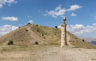
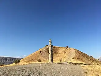 The Karakuş Tumulus is a monumental tomb of Royal Family of Commagene located in the district. | |
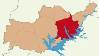 Map showing Kâhta District in Adıyaman Province | |
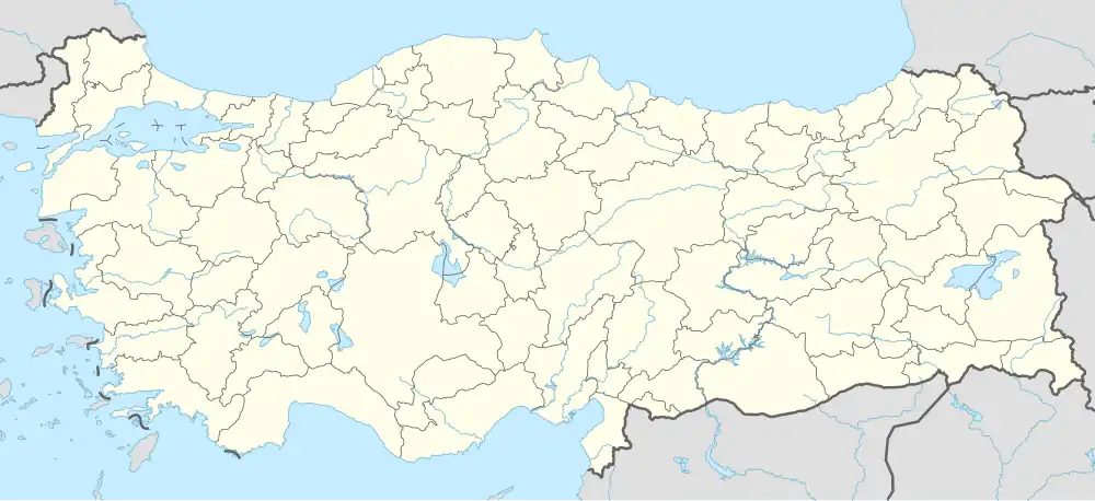 Kâhta District Location in Turkey | |
| Coordinates: 37°47′N 38°37′E / 37.783°N 38.617°E | |
| Country | Turkey |
| Province | Adıyaman |
| Seat | Kâhta |
| Government | |
| • Kaymakam | Selami Korkutata |
Area | 1,274 km2 (492 sq mi) |
| Population (2021) | 127,534 |
| • Density | 100/km2 (260/sq mi) |
| Time zone | UTC+3 (TRT) |
Kâhta District is a district of Adıyaman Province of Turkey. Its seat is the town Kâhta.[1] Its area is 1,274 km2,[2] and its population is 127,534 (2021).[3] On 12 October 2018, cave drawings which date back to the Paleolithic era, were discovered in the Kâhta district, due to the decline of Atatürk Reservoir waters by 10–15 meters.[4]
Composition
There are 3 municipalities in Kâhta District:[1][5]
There are 102 villages in Kâhta District:[6]
- Adalı
- Akalın
- Akdoğan
- Akkavak
- Akkuş
- Aktaş
- Akyıldız
- Alidam
- Arılı
- Aydınpınar
- Bağbaşı
- Bağözü
- Ballı
- Belenli
- Belören
- Beşikli
- Boğazkaya
- Bostanlı
- Bozpınar
- Boztarla
- Burmapınar
- Büyükbağ
- Büyükbejyan
- Büyükbey
- Çakıreşme
- Çaltılı
- Çamlica
- Çardak
- Çataltepe
- Çaybaşı
- Çıralık
- Çukurtaş
- Cumhuriyet
- Damlacık
- Dardağan
- Dikenli
- Doluca
- Dumlu
- Dut
- Eceler
- Ekinci
- Elbeyi
- Erikdere
- Erikli
- Esendere
- Eski Kâhta
- Eskitaş
- Fıstıklı
- Geldibuldu
- Göçeri
- Gökçe
- Gölgeli
- Güdülge
- Güzelçay
- Habipler
- Hacıyusuf
- Hamzalar
- Hasandiğin
- Hasköy
- İkizce
- Işıktepe
- İslamköy
- Karacaören
- Karadut
- Karaman
- Karataş
- Kavaklı
- Kayadibi
- Koçtepe
- Köseler
- Kozağaç
- Menzil
- Mülk
- Narince
- Narlıdere
- Narsırtı
- Oluklu
- Ortanca
- Ovacık
- Şahintepe
- Salkımbağı
- Sarısu
- Şenköy
- Sıraca
- Sırakaya
- Susuz
- Taşlıca
- Taşlıçay
- Teğmenli
- Teknecik
- Tuğlu
- Turanlı
- Tütenocak
- Ulupınar
- Yapraklı
- Yelkovan
- Yenice
- Yenikuşak
- Yeşilkaya
- Yolaltı
- Zeytin
- Ziyaret
Places of interest
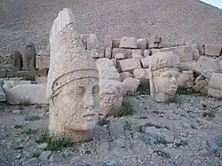
- Nemrut Dağı or Mount Nemrut - now a national park, famous for the antique statuary on the summit, dating back to the Commagene Kingdom.
- Karakuş Tumulus, with a large statue of an eagle.
- Kâhta castle
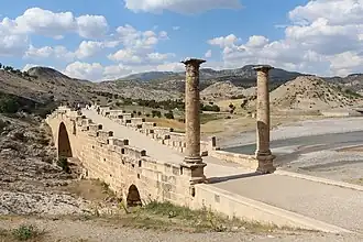
- Severan Bridge, a Roman bridge.
-
-
 Tumulus of Karakuş
 -
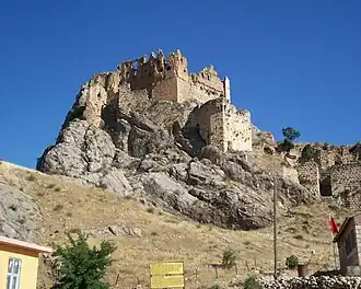 Kahta castle
 -
References
- ^ a b İlçe Belediyesi Archived 2015-07-06 at the Wayback Machine, Turkey Civil Administration Departments Inventory. Retrieved 12 January 2023.
- ^ "İl ve İlçe Yüz ölçümleri". General Directorate of Mapping. Retrieved 12 January 2023.
- ^ "Address-based population registration system (ADNKS) results dated 31 December 2021" (XLS) (in Turkish). TÜİK. Retrieved 12 January 2023.
- ^ "Paleolithic art unveiled after dam water ebbs in Turkey's east". Hürriyet Daily News. 12 October 2018.
- ^ Belde Belediyesi Archived 2015-07-06 at the Wayback Machine, Turkey Civil Administration Departments Inventory. Retrieved 13 January 2023.
- ^ Köy Archived 2015-07-06 at the Wayback Machine, Turkey Civil Administration Departments Inventory. Retrieved 12 January 2023.
Kâhta District in Adıyaman Province of Turkey | |||||||||||||||||||||||||||
|---|---|---|---|---|---|---|---|---|---|---|---|---|---|---|---|---|---|---|---|---|---|---|---|---|---|---|---|
| Districts | 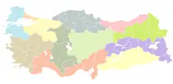 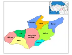 | ||||||||||||||||||||||||||
|
Metropolitan municipalities are bolded. | |||||||||||||||||||||||||||