Kell am See
Kell am See | |
|---|---|
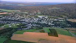 Aerial view | |
 Coat of arms | |
Location of Kell am See within Trier-Saarburg district 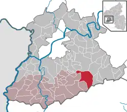 | |
 Kell am See 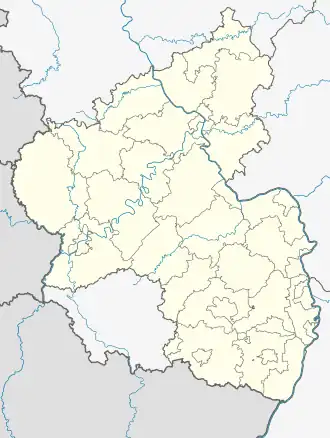 Kell am See | |
| Coordinates: 49°38′0.3″N 6°49′20.13″E / 49.633417°N 6.8222583°E | |
| Country | Germany |
| State | Rhineland-Palatinate |
| District | Trier-Saarburg |
| Municipal assoc. | Saarburg-Kell |
| Government | |
| • Mayor (2019–24) | Markus Lehnen[1] (CDU) |
| Area | |
• Total | 28.26 km2 (10.91 sq mi) |
| Elevation | 480 m (1,570 ft) |
| Population (2023-12-31)[2] | |
• Total | 2,031 |
| • Density | 72/km2 (190/sq mi) |
| Time zone | UTC+01:00 (CET) |
| • Summer (DST) | UTC+02:00 (CEST) |
| Postal codes | 54427 |
| Dialling codes | 06589 |
| Vehicle registration | TR |
| Website | www.kellamsee.de |
Kell am See is a municipality in the Trier-Saarburg district, in Rhineland-Palatinate, Germany. It is situated in the Hunsrück, approx. 20 km southeast of Trier.
Kell am See was the seat of the former Kell am See Verbandsgemeinde ("collective municipality").
Until 2013, there was a yearly festival in Kell which is called Highway To Kell.[3]
References
- ^ Direktwahlen 2019, Landkreis Trier-Saarburg, Landeswahlleiter Rheinland-Pfalz, accessed 2 August 2021.
- ^ Bevölkerungsstand 31. Dezember 2023, Landkreise, Gemeinden, Verbandsgemeinden; Fortschreibung des Zensus 2011 (in German), Statistisches Landesamt Rheinland-Pfalz, 2024
- ^ Save the Date 16.07.2022, Highway to Kell
External links
- Official website
 (in German)
 - www.highway-to-kell.de