Kincumber South, New South Wales
| Kincumber South Central Coast, New South Wales | |||||||||||||||
|---|---|---|---|---|---|---|---|---|---|---|---|---|---|---|---|
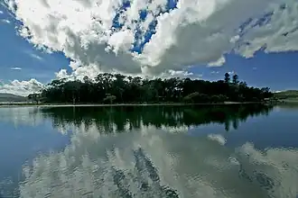 Kincumber South over the water viewed from Davistown | |||||||||||||||
| Population | 681 (2011 census)[1] | ||||||||||||||
| • Density | 524/km2 (1,360/sq mi) | ||||||||||||||
| Postcode(s) | 2251 | ||||||||||||||
| Elevation | 14 m (46 ft) | ||||||||||||||
| Area | 1.3 km2 (0.5 sq mi) | ||||||||||||||
| Location |
| ||||||||||||||
| LGA(s) | Central Coast Council | ||||||||||||||
| Parish | Kincumber | ||||||||||||||
| State electorate(s) | Terrigal | ||||||||||||||
| Federal division(s) | Robertson | ||||||||||||||
| |||||||||||||||
Kincumber South is a south-eastern suburb of the Central Coast region of New South Wales, Australia. It is part of the Central Coast Council local government area.
References
- ^ Australian Bureau of Statistics (31 October 2012). "Kincumber South (State Suburb)". 2011 Census QuickStats. Retrieved 24 October 2013.
33°28′55″S 151°22′05″E / 33.482°S 151.368°E