Kirchschlag, Zwettl
Kirchschlag | |
|---|---|
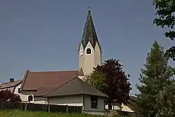 Kirchschlag parish church | |
 Coat of arms | |
 Kirchschlag Location within Austria | |
| Coordinates: 48°23′00″N 15°13′00″E / 48.38333°N 15.21667°E | |
| Country | Austria |
| State | Lower Austria |
| District | Zwettl |
| Government | |
| • Mayor | Johann Stieger (ÖVP) |
| Area | |
• Total | 29.3 km2 (11.3 sq mi) |
| Elevation | 820 m (2,690 ft) |
| Population (2018-01-01)[2] | |
• Total | 621 |
| • Density | 21/km2 (55/sq mi) |
| Time zone | UTC+1 (CET) |
| • Summer (DST) | UTC+2 (CEST) |
| Postal code | 3631 |
| Area code | 02872 |
| Vehicle registration | ZT |
| Website | www.kirchschlag.gv.at |
Kirchschlag is a municipality in the district of Zwettl in the Austrian state of Lower Austria.
Population
| Year | Pop. | ±% |
|---|---|---|
| 1971 | 883 | — |
| 1981 | 795 | −10.0% |
| 1991 | 738 | −7.2% |
| 2001 | 717 | −2.8% |
References
- ^ "Dauersiedlungsraum der Gemeinden Politischen Bezirke und Bundesländer - Gebietsstand 1.1.2018". Statistics Austria. Retrieved 10 March 2019.
- ^ "Einwohnerzahl 1.1.2018 nach Gemeinden mit Status, Gebietsstand 1.1.2018". Statistics Austria. Retrieved 9 March 2019.