Rappottenstein
Rappottenstein | |
|---|---|
 Coat of arms | |
 Rappottenstein Location within Austria | |
| Coordinates: 48°31′00″N 15°04′00″E / 48.51667°N 15.06667°E | |
| Country | Austria |
| State | Lower Austria |
| District | Zwettl |
| Government | |
| • Mayor | Friedrich Wagner (ÖVP) |
| Area | |
• Total | 65.77 km2 (25.39 sq mi) |
| Elevation | 671 m (2,201 ft) |
| Population (2018-01-01)[2] | |
• Total | 1,724 |
| • Density | 26/km2 (68/sq mi) |
| Time zone | UTC+1 (CET) |
| • Summer (DST) | UTC+2 (CEST) |
| Postal code | 3911 |
| Area code | 02828 |
| Vehicle registration | ZT |
| Website | www.rappottenstein.at |
Rappottenstein is a municipality in the district of Zwettl in the Austrian state of Lower Austria.
Gallery
-
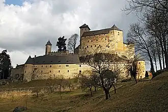
.JPG) Rappottestein Castle
Rappottestein Castle -
.JPG) Rappottenstein Castle
Rappottenstein Castle -
.JPG) Rappottenstein Castle
Rappottenstein Castle -
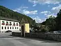 View in Rappottenstein
 -
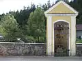 Rappottenstein Shrine by roadside
 -
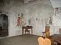 Rappotenstein Painted room in Castle
 -
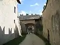 Rappotenstein Castle Lower gateway
 -
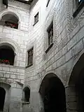 Rappottenstein Castle Courtyard
References
- ^ "Dauersiedlungsraum der Gemeinden Politischen Bezirke und Bundesländer - Gebietsstand 1.1.2018". Statistics Austria. Retrieved 10 March 2019.
- ^ "Einwohnerzahl 1.1.2018 nach Gemeinden mit Status, Gebietsstand 1.1.2018". Statistics Austria. Retrieved 9 March 2019.
Places adjacent to Rappottenstein | ||||||||||||||||
|---|---|---|---|---|---|---|---|---|---|---|---|---|---|---|---|---|
| ||||||||||||||||