Kojetice (Mělník District)
Kojetice | |
|---|---|
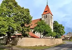 Church of Saint Vitus | |
.svg.png) Flag .svg.png) Coat of arms | |
 Kojetice Location in the Czech Republic | |
| Coordinates: 50°14′17″N 14°30′31″E / 50.23806°N 14.50861°E | |
| Country | |
| Region | Central Bohemian |
| District | Mělník |
| First mentioned | 1271 |
| Area | |
• Total | 5.58 km2 (2.15 sq mi) |
| Elevation | 215 m (705 ft) |
| Population (2025-01-01)[1] | |
• Total | 1,027 |
| • Density | 180/km2 (480/sq mi) |
| Time zone | UTC+1 (CET) |
| • Summer (DST) | UTC+2 (CEST) |
| Postal code | 250 72 |
| Website | www |
Kojetice is a municipality and village in Mělník District in the Central Bohemian Region of the Czech Republic. It has about 1,000 inhabitants.
History
The first written mention of Kojetice is from 1271.[2]
Demographics
| Year | Pop. | ±% |
|---|---|---|
| 1869 | 370 | — |
| 1880 | 415 | +12.2% |
| 1890 | 393 | −5.3% |
| 1900 | 362 | −7.9% |
| 1910 | 398 | +9.9% |
| 1921 | 493 | +23.9% |
| 1930 | 809 | +64.1% |
| 1950 | 622 | −23.1% |
| 1961 | 729 | +17.2% |
| 1970 | 759 | +4.1% |
| 1980 | 724 | −4.6% |
| 1991 | 638 | −11.9% |
| 2001 | 627 | −1.7% |
| 2011 | 741 | +18.2% |
| 2021 | 811 | +9.4% |
| Source: Censuses[3][4] | ||
References
- ^ "Population of Municipalities – 1 January 2025". Czech Statistical Office. 2025-05-16.
- ^ "740 let uplynulo od uvedení první písemné zmínky o existenci obce". Kojetický zpravodaj č.2/2011 (in Czech). Obec Kojetice. 2011-02-11. p. 7. Retrieved 2022-05-03.
- ^ "Historický lexikon obcí České republiky 1869–2011" (in Czech). Czech Statistical Office. 2015-12-21.
- ^ "Population Census 2021: Population by sex". Public Database. Czech Statistical Office. 2021-03-27.
External links
Wikimedia Commons has media related to Kojetice (Mělník District).