Olovnice
Olovnice | |
|---|---|
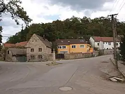 Crossroads | |
_vlajka.jpg) Flag _znak.jpg) Coat of arms | |
 Olovnice Location in the Czech Republic | |
| Coordinates: 50°14′5″N 14°14′26″E / 50.23472°N 14.24056°E | |
| Country | |
| Region | Central Bohemian |
| District | Mělník |
| First mentioned | 1285 |
| Area | |
• Total | 5.88 km2 (2.27 sq mi) |
| Elevation | 193 m (633 ft) |
| Population (2025-01-01)[1] | |
• Total | 579 |
| • Density | 98/km2 (260/sq mi) |
| Time zone | UTC+1 (CET) |
| • Summer (DST) | UTC+2 (CEST) |
| Postal code | 278 01 |
| Website | www |
Olovnice is a municipality and village in Mělník District in the Central Bohemian Region of the Czech Republic. It has about 600 inhabitants.
Demographics
| Year | Pop. | ±% |
|---|---|---|
| 1869 | 603 | — |
| 1880 | 647 | +7.3% |
| 1890 | 685 | +5.9% |
| 1900 | 769 | +12.3% |
| 1910 | 802 | +4.3% |
| 1921 | 663 | −17.3% |
| 1930 | 687 | +3.6% |
| 1950 | 639 | −7.0% |
| 1961 | 675 | +5.6% |
| 1970 | 655 | −3.0% |
| 1980 | 547 | −16.5% |
| 1991 | 389 | −28.9% |
| 2001 | 435 | +11.8% |
| 2011 | 484 | +11.3% |
| 2021 | 562 | +16.1% |
| Source: Censuses[2][3] | ||
References
- ^ "Population of Municipalities – 1 January 2025". Czech Statistical Office. 2025-05-16.
- ^ "Historický lexikon obcí České republiky 1869–2011" (in Czech). Czech Statistical Office. 2015-12-21.
- ^ "Population Census 2021: Population by sex". Public Database. Czech Statistical Office. 2021-03-27.
External links
Wikimedia Commons has media related to Olovnice (Mělník District).