Kostelec (Jičín District)
Kostelec | |
|---|---|
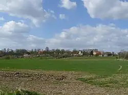 General view | |
 Kostelec Location in the Czech Republic | |
| Coordinates: 50°22′53″N 15°19′38″E / 50.38139°N 15.32722°E | |
| Country | |
| Region | Hradec Králové |
| District | Jičín |
| First mentioned | 1320 |
| Area | |
• Total | 2.26 km2 (0.87 sq mi) |
| Elevation | 297 m (974 ft) |
| Population (2025-01-01)[1] | |
• Total | 38 |
| • Density | 17/km2 (44/sq mi) |
| Time zone | UTC+1 (CET) |
| • Summer (DST) | UTC+2 (CEST) |
| Postal code | 506 01 |
| Website | www |
Kostelec is a municipality and village in Jičín District in the Hradec Králové Region of the Czech Republic. It has about 40 inhabitants.
Demographics
| Year | Pop. | ±% |
|---|---|---|
| 1869 | 126 | — |
| 1880 | 113 | −10.3% |
| 1890 | 127 | +12.4% |
| 1900 | 106 | −16.5% |
| 1910 | 139 | +31.1% |
| 1921 | 140 | +0.7% |
| 1930 | 126 | −10.0% |
| 1950 | 95 | −24.6% |
| 1961 | 68 | −28.4% |
| 1970 | 66 | −2.9% |
| 1980 | 63 | −4.5% |
| 1991 | 52 | −17.5% |
| 2001 | 42 | −19.2% |
| 2011 | 40 | −4.8% |
| 2021 | 37 | −7.5% |
| Source: Censuses[2][3] | ||
References
- ^ "Population of Municipalities – 1 January 2025". Czech Statistical Office. 2025-05-16.
- ^ "Historický lexikon obcí České republiky 1869–2011" (in Czech). Czech Statistical Office. 2015-12-21.
- ^ "Population Census 2021: Population by sex". Public Database. Czech Statistical Office. 2021-03-27.
External links
Wikimedia Commons has media related to Kostelec (Jičín District).