Kozojedy (Prague-East District)
Kozojedy | |
|---|---|
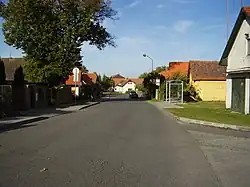 Main street | |
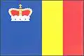 Flag 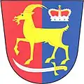 Coat of arms | |
 Kozojedy Location in the Czech Republic | |
| Coordinates: 49°59′50″N 14°48′58″E / 49.99722°N 14.81611°E | |
| Country | |
| Region | Central Bohemian |
| District | Prague-East |
| First mentioned | 1352 |
| Area | |
• Total | 7.18 km2 (2.77 sq mi) |
| Elevation | 368 m (1,207 ft) |
| Population (2025-01-01)[1] | |
• Total | 1,004 |
| • Density | 140/km2 (360/sq mi) |
| Time zone | UTC+1 (CET) |
| • Summer (DST) | UTC+2 (CEST) |
| Postal code | 281 63 |
| Website | www |
Kozojedy is a municipality and village in Prague-East District in the Central Bohemian Region of the Czech Republic. It has about 1,000 inhabitants.
Demographics
| Year | Pop. | ±% |
|---|---|---|
| 1869 | 522 | — |
| 1880 | 577 | +10.5% |
| 1890 | 577 | +0.0% |
| 1900 | 567 | −1.7% |
| 1910 | 578 | +1.9% |
| 1921 | 545 | −5.7% |
| 1930 | 512 | −6.1% |
| 1950 | 544 | +6.2% |
| 1961 | 512 | −5.9% |
| 1970 | 524 | +2.3% |
| 1980 | 497 | −5.2% |
| 1991 | 506 | +1.8% |
| 2001 | 508 | +0.4% |
| 2011 | 668 | +31.5% |
| 2021 | 956 | +43.1% |
| Source: Censuses[2][3] | ||
References
- ^ "Population of Municipalities – 1 January 2025". Czech Statistical Office. 2025-05-16.
- ^ "Historický lexikon obcí České republiky 1869–2011" (in Czech). Czech Statistical Office. 2015-12-21.
- ^ "Population Census 2021: Population by sex". Public Database. Czech Statistical Office. 2021-03-27.
External links
Wikimedia Commons has media related to Kozojedy (Prague-East District).