Krychnov
Krychnov | |
|---|---|
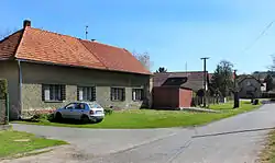 Eastern part of Krychlov | |
 Krychnov Location in the Czech Republic | |
| Coordinates: 50°0′22″N 15°3′28″E / 50.00611°N 15.05778°E | |
| Country | |
| Region | Central Bohemian |
| District | Kolín |
| First mentioned | 1436 |
| Area | |
• Total | 2.58 km2 (1.00 sq mi) |
| Elevation | 269 m (883 ft) |
| Population (2025-01-01)[1] | |
• Total | 107 |
| • Density | 41/km2 (110/sq mi) |
| Time zone | UTC+1 (CET) |
| • Summer (DST) | UTC+2 (CEST) |
| Postal code | 280 02 |
| Website | www |
Krychnov is a municipality and village in Kolín District in the Central Bohemian Region of the Czech Republic. It has about 100 inhabitants.
Demographics
| Year | Pop. | ±% |
|---|---|---|
| 1869 | 265 | — |
| 1880 | 286 | +7.9% |
| 1890 | 306 | +7.0% |
| 1900 | 299 | −2.3% |
| 1910 | 267 | −10.7% |
| 1921 | 243 | −9.0% |
| 1930 | 216 | −11.1% |
| 1950 | 148 | −31.5% |
| 1961 | 177 | +19.6% |
| 1970 | 172 | −2.8% |
| 1980 | 147 | −14.5% |
| 1991 | 107 | −27.2% |
| 2001 | 101 | −5.6% |
| 2011 | 108 | +6.9% |
| 2021 | 104 | −3.7% |
| Source: Censuses[2][3] | ||
References
- ^ "Population of Municipalities – 1 January 2025". Czech Statistical Office. 2025-05-16.
- ^ "Historický lexikon obcí České republiky 1869–2011" (in Czech). Czech Statistical Office. 2015-12-21.
- ^ "Population Census 2021: Population by sex". Public Database. Czech Statistical Office. 2021-03-27.
External links
Wikimedia Commons has media related to Krychnov.