Ratenice
Ratenice | |
|---|---|
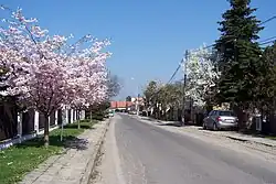 Main street | |
 Flag  Coat of arms | |
 Ratenice Location in the Czech Republic | |
| Coordinates: 50°5′30″N 15°3′34″E / 50.09167°N 15.05944°E | |
| Country | |
| Region | Central Bohemian |
| District | Kolín |
| First mentioned | 1340 |
| Area | |
• Total | 4.73 km2 (1.83 sq mi) |
| Elevation | 196 m (643 ft) |
| Population (2025-01-01)[1] | |
• Total | 687 |
| • Density | 150/km2 (380/sq mi) |
| Time zone | UTC+1 (CET) |
| • Summer (DST) | UTC+2 (CEST) |
| Postal code | 289 11 |
| Website | www |
Ratenice is a municipality and village in Kolín District in the Central Bohemian Region of the Czech Republic. It has about 700 inhabitants. It is located in the Polabí lowlands.
Demographics
| Year | Pop. | ±% |
|---|---|---|
| 1869 | 546 | — |
| 1880 | 622 | +13.9% |
| 1890 | 741 | +19.1% |
| 1900 | 676 | −8.8% |
| 1910 | 800 | +18.3% |
| 1921 | 828 | +3.5% |
| 1930 | 899 | +8.6% |
| 1950 | 692 | −23.0% |
| 1961 | 680 | −1.7% |
| 1970 | 597 | −12.2% |
| 1980 | 484 | −18.9% |
| 1991 | 411 | −15.1% |
| 2001 | 476 | +15.8% |
| 2011 | 562 | +18.1% |
| 2021 | 638 | +13.5% |
| Source: Censuses[2][3] | ||
References
- ^ "Population of Municipalities – 1 January 2025". Czech Statistical Office. 2025-05-16.
- ^ "Historický lexikon obcí České republiky 1869–2011" (in Czech). Czech Statistical Office. 2015-12-21.
- ^ "Population Census 2021: Population by sex". Public Database. Czech Statistical Office. 2021-03-27.
External links
Wikimedia Commons has media related to Ratenice.