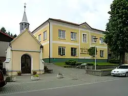
Lípa (Zlín District)
Lípa | |
|---|---|
 Municipal office | |
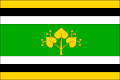 Flag 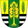 Coat of arms | |
 Lípa Location in the Czech Republic | |
| Coordinates: 49°12′55″N 17°46′7″E / 49.21528°N 17.76861°E | |
| Country | |
| Region | Zlín |
| District | Zlín |
| First mentioned | 1261 |
| Area | |
• Total | 8.35 km2 (3.22 sq mi) |
| Elevation | 249 m (817 ft) |
| Population (2025-01-01)[1] | |
• Total | 848 |
| • Density | 100/km2 (260/sq mi) |
| Time zone | UTC+1 (CET) |
| • Summer (DST) | UTC+2 (CEST) |
| Postal code | 763 11 |
| Website | www |
Lípa is a municipality and village in Zlín District in the Zlín Region of the Czech Republic. It has about 800 inhabitants.
Lípa lies on the Dřevnice River, approximately 9 kilometres (6 mi) east of Zlín and 261 km (162 mi) east of Prague.
Demographics
| Year | Pop. | ±% |
|---|---|---|
| 1869 | 630 | — |
| 1880 | 638 | +1.3% |
| 1890 | 622 | −2.5% |
| 1900 | 705 | +13.3% |
| 1910 | 693 | −1.7% |
| 1921 | 738 | +6.5% |
| 1930 | 864 | +17.1% |
| 1950 | 859 | −0.6% |
| 1961 | 895 | +4.2% |
| 1970 | 866 | −3.2% |
| 1980 | 730 | −15.7% |
| 1991 | 657 | −10.0% |
| 2001 | 629 | −4.3% |
| 2011 | 746 | +18.6% |
| 2021 | 828 | +11.0% |
| Source: Censuses[2][3] | ||
References
- ^ "Population of Municipalities – 1 January 2025". Czech Statistical Office. 2025-05-16.
- ^ "Historický lexikon obcí České republiky 1869–2011" (in Czech). Czech Statistical Office. 2015-12-21.
- ^ "Population Census 2021: Population by sex". Public Database. Czech Statistical Office. 2021-03-27.
External links
Wikimedia Commons has media related to Lípa (Zlín District).