L'Étang-Vergy
L'Étang-Vergy | |
|---|---|
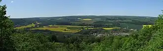 A general view of L'Étang-Vergy | |
.svg.png) Coat of arms | |
Location of L'Étang-Vergy | |
 L'Étang-Vergy  L'Étang-Vergy | |
| Coordinates: 47°10′42″N 4°52′42″E / 47.1783°N 4.8783°E | |
| Country | France |
| Region | Bourgogne-Franche-Comté |
| Department | Côte-d'Or |
| Arrondissement | Beaune |
| Canton | Longvic |
| Intercommunality | Gevrey-Chambertin et Nuits-Saint-Georges |
| Government | |
| • Mayor (2020–2026) | Gilles Malsert[1] |
Area 1 | 2.65 km2 (1.02 sq mi) |
| Population (2022)[2] | 203 |
| • Density | 77/km2 (200/sq mi) |
| Time zone | UTC+01:00 (CET) |
| • Summer (DST) | UTC+02:00 (CEST) |
| INSEE/Postal code | 21254 /21220 |
| Elevation | 302–500 m (991–1,640 ft) |
| 1 French Land Register data, which excludes lakes, ponds, glaciers > 1 km2 (0.386 sq mi or 247 acres) and river estuaries. | |
L'Étang-Vergy (French pronunciation: [letɑ̃ vɛʁʒi]) is a commune in the Côte-d'Or department in eastern France.
Population
| Year | Pop. | ±% |
|---|---|---|
| 1962 | 172 | — |
| 1968 | 176 | +2.3% |
| 1975 | 160 | −9.1% |
| 1982 | 163 | +1.9% |
| 1990 | 150 | −8.0% |
| 1999 | 183 | +22.0% |
| 2008 | 199 | +8.7% |
See also
References
- ^ "Répertoire national des élus: les maires". data.gouv.fr, Plateforme ouverte des données publiques françaises (in French). 9 August 2021.
- ^ "Populations de référence 2022" (in French). The National Institute of Statistics and Economic Studies. 19 December 2024.
Wikimedia Commons has media related to L'Étang-Vergy.