Labruguière
Labruguière | |
|---|---|
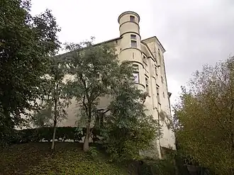 The chateau in Labruguière | |
.svg.png) Coat of arms | |
Location of Labruguière | |
 Labruguière  Labruguière | |
| Coordinates: 43°32′24″N 2°15′49″E / 43.54°N 2.2636°E | |
| Country | France |
| Region | Occitania |
| Department | Tarn |
| Arrondissement | Castres |
| Canton | La Montagne noire |
| Intercommunality | CA Castres Mazamet |
| Government | |
| • Mayor (2020–2026) | David Cucullières[1] |
Area 1 | 60.73 km2 (23.45 sq mi) |
| Population (2022)[2] | 6,567 |
| • Density | 110/km2 (280/sq mi) |
| Time zone | UTC+01:00 (CET) |
| • Summer (DST) | UTC+02:00 (CEST) |
| INSEE/Postal code | 81120 /81290 |
| Elevation | 174–1,027 m (571–3,369 ft) (avg. 180 m or 590 ft) |
| Website | labruguiere |
| 1 French Land Register data, which excludes lakes, ponds, glaciers > 1 km2 (0.386 sq mi or 247 acres) and river estuaries. | |
Labruguière (French pronunciation: [labʁyɡjɛʁ]; Languedocien: La Bruguièira) is a commune in the Tarn department in southern France.
The Thoré is a river that is part of the commune's eastern border, flows north-northwestward through the northern part of the commune, crosses the village, then forms part of its northern border.
Population
Its inhabitants are called Labruguiérois in French.
| Year | Pop. | ±% p.a. |
|---|---|---|
| 1968 | 5,333 | — |
| 1975 | 5,468 | +0.36% |
| 1982 | 5,541 | +0.19% |
| 1990 | 5,486 | −0.12% |
| 1999 | 5,488 | +0.00% |
| 2007 | 5,904 | +0.92% |
| 2012 | 6,365 | +1.52% |
| 2017 | 6,535 | +0.53% |
| Source: INSEE[3] | ||
See also
References
- ^ "Répertoire national des élus: les maires" (in French). data.gouv.fr, Plateforme ouverte des données publiques françaises. 13 September 2022.
- ^ "Populations de référence 2022" (in French). The National Institute of Statistics and Economic Studies. 19 December 2024.
- ^ Population en historique depuis 1968, INSEE
Wikimedia Commons has media related to Labruguière.