Lalganj, Uttar Pradesh
Lalganj | |
|---|---|
Town | |
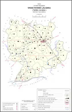 Map of Lalganj CD block | |
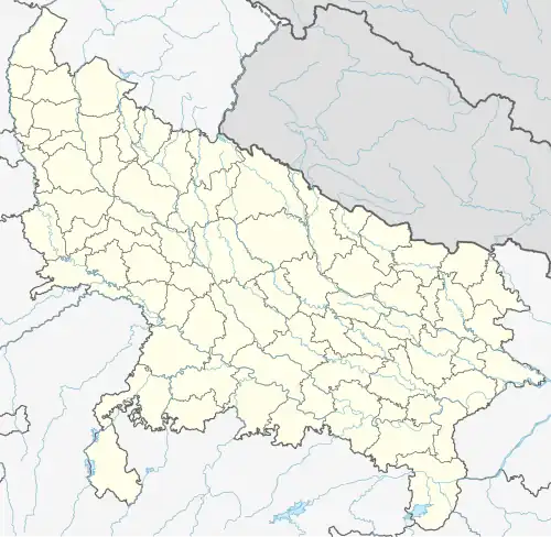 Lalganj Location in Uttar Pradesh, India 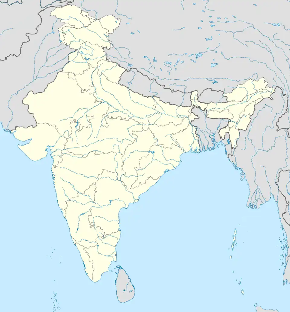 Lalganj Lalganj (India) | |
| Coordinates: 26°07′40″N 80°47′08″E / 26.12766°N 80.7855°E | |
| Country | |
| State | Uttar Pradesh |
| District | Raebareli |
| Government | |
| • MP | Rahul Gandhi |
| Area | |
• Total | 4.12 km2 (1.59 sq mi) |
| • Rank | Raebareli Division |
| Elevation | 142 m (466 ft) |
| Population (2011)[1] | |
• Total | 23,124 |
| • Density | 5,600/km2 (15,000/sq mi) |
| Languages | |
| • Official | Hindi |
| • Regional | Awadhi,Hindil Language |
| Time zone | UTC+5:30 (IST) |
| PIN | 229206 |
| Vehicle registration | UP-33 |
| Sex ratio | 75.5 ♂/♀ |
| Website | up |
Lalganj is a town and nagar panchayat (municipality) in Raebareli district of Uttar Pradesh, India.[1]
As of 2011 Lalganj had a population of 23,124, in 3,996 households.[1]
History
Lalganj was founded by, and named after, Lal Singh of Simarpaha.[2]
At the turn of the 20th century, Lalganj was described as "a flourishing little market town" that served as the second-most-important bazar in the district, behind Raebareli itself.[2] It hosted markets twice a week and traded hides, cloth, and oilseeds with Kanpur.[2] Because of the town's growing importance, the road between Lalganj and Raebareli was metalled in 1902 through 1904.[2] At around that time, Lalganj had a police station, a post office, a cattle pound, and a large primary school, as well as a road inspection bungalow that had recently been built.[2] The town had a large Bania population as well as a Bais colony.[2] Lalganj was then technically part of the village of Datauli Lalganj; Datauli had been founded by Sheo Singh, an ancestor of Lal Singh.[2]
Demographics
| Year | Pop. | ±% |
|---|---|---|
| 1941 | 2,280 | — |
| 1951 | 3,345 | +46.7% |
| 1961 | Not given | — |
| 1971 | Not given | — |
| 1981 | 10,605 | — |
| 1991 | 15,405 | +45.3% |
| 2001 | 21,142 | +37.2% |
| 2011 | 23,124 | +9.4% |
| Source: 2011 Census of India[1] | ||
According to the 2011 census, Lalganj has a population of 23,124 people, in 3,996 households.[1] The town's sex ratio is 914 females to every 1000 males, which is the lowest among towns in Raebareli district; 12,082 of Lalganj's residents are male (52.2%) and 11,042 are female (47.8%).[1] The 0-6 age group makes up about 10.3% of the town's population; the sex ratio for this group is 857, which is also the lowest in the district.[1] Members of Scheduled Castes make up 14.78% of the town's population, while members of Scheduled Tribes make up 0.12%.[1] Lalganj's literacy rate was 86.07% (counting only people age 7 and up), which was the highest among towns in the district; literacy was higher among men and boys (91.2%) than among women and girls (80.5%).[1] The scheduled castes literacy rate is 75.52% (84.15% among men and boys, and 65.74% among women and girls).[1]
In terms of employment, 23.09% of Lalganj residents were classified as main workers (i.e. people employed for at least 6 months per year) in 2011.[1] Marginal workers (i.e. people employed for less than 6 months per year) made up 5.81%, and the remaining 71.10% were non-workers.[1] Employment status varied significantly according to gender, with 47.08% of men being either main or marginal workers, compared to 9.01% of women.[1]
55.63% of Lalganj residents live in slum conditions as of 2011.[1] There are 10 slum areas in Lalganj: Adarsh Nagar, Chaman Ganj, Chikvahi, Domahi, Mahesh Kheda, Pure Baba, Ali Nagar, Krishna Nagar, Sudan Kheda, and Pure Debi.[1] These range in size from about 101 to 455 households and have between 8 and 13 tap water access points.[1] The number of flush toilets installed in people's homes ranges from 91 to 338.[1] All 10 areas are serviced by a mix of open and closed sewers.[1]
Villages
Lalganj CD block has the following 92 villages:[1]
| Village name | Total land area (hectares) | Population (in 2011) |
|---|---|---|
| Deopur | 375.6 | 1,171 |
| Sakatpur | 210.1 | 1,906 |
| Gahiri | 613.2 | 4,259 |
| Sarai | 77.6 | 902 |
| Jogapur Barigaon | 648.6 | 4,081 |
| Baraha | 245.6 | 1,656 |
| Matehana | 97.3 | 1,138 |
| Saimbasi | 168.8 | 1,225 |
| Fatte Sarai | 65.2 | 295 |
| Khanpur Khapura | 102.9 | 394 |
| Bandai | 340.3 | 3,204 |
| Rewari Pasiya Khera | 209.4 | 1,202 |
| Behta Kalan | 781.8 | 6,148 |
| Shahpur | 141.8 | 689 |
| Maha Khera | 78.2 | 1,515 |
| Pratappur | 53.5 | 417 |
| Sarai Kurmi | 178.3 | 843 |
| Champatpur | 133.8 | 685 |
| Bemoura Mahesh Khera | 545.4 | 1,946 |
| Haripur | 127.3 | 1,527 |
| Pure Ori | 52.8 | 836 |
| Dhannipur | 62 | 1,053 |
| Dayalpur | 45 | 728 |
| Basu Gari | 33.4 | 605 |
| Mubarakpur | 124 | 1,217 |
| Ranipur | 172.9 | 1,418 |
| Uga Bhad | 369.8 | 1,633 |
| Dhana Bhad | 255.3 | 2,007 |
| Maduri | 293.2 | 1,928 |
| Narsinghpur | 93.6 | 655 |
| Dostpur | 48.9 | 295 |
| Pure Bhawani | 70.8 | 260 |
| Kumhraura | 307.1 | 2,895 |
| Malpura | 58.9 | 867 |
| Chanda | 225.9 | 1,246 |
| Yusufpur | 477.6 | 2,905 |
| Banna Mau | 246 | 1,862 |
| Ran Gaon | 243 | 1,764 |
| Mirzapur Urf Toadhakpur | 63.2 | 833 |
| Shekhwapur | 78 | 597 |
| Govindpur Valauli | 142.3 | 2,010 |
| Trivedipur | 61.8 | 800 |
| Mahmad Mau | 142.7 | 838 |
| Datauli Lal Ganj | 267.7 | 3,690 |
| Jamuwanwa | 284.3 | 1,060 |
| Alampur | 209.1 | 5,162 |
| Suddan Khera | 30.1 | 1,808 |
| Korihara | 237.2 | 3,149 |
| Chachiha | 126.8 | 933 |
| Semer Paha | 786.9 | 8,391 |
| Shobhwapur | 198.7 | 2,231 |
| Aanapur | 126.2 | 896 |
| Bishun Khera | 118.1 | 1,166 |
| Jhavar Hardi Patti | 73.8 | 1,476 |
| Jagatpur Bhichkaura | 291.9 | 2,401 |
| Sandi | 50.1 | 228 |
| Paliyavir Singhpur | 283.2 | 1,776 |
| Maide Mau | 157.2 | 1,027 |
| Narendrapur | 84.9 | 326 |
| Sarai Bairiha Khera | 419.5 | 2,485 |
| Kankapur | 149.8 | 516 |
| Gougu Mau | 112 | 976 |
| Bahrampur | 118.5 | 1,210 |
| Gunagar Khera | 80.4 | 169 |
| Golha Mau | 74.1 | 360 |
| Udwa Mau | 236.8 | 1,093 |
| Chorahiya | 157.2 | 301 |
| Tila | 91.4 | 839 |
| Sadipur Bargadha | 57 | 352 |
| Mithapur Barhaiya | 180.7 | 1,793 |
| Saraila | 75.6 | 385 |
| Khajur Gaon Mu. | 472.2 | 5,916 |
| Khajur Gaon Aht. | 830 | 31 |
| Janewa Katra Mu. | 172.1 | 1,040 |
| Janewa Katra Aht. | 20.4 | 0 |
| Gegaso Mu. | 375 | 2,878 |
| Gegaso Aht. | 51.8 | 1 |
| Bajpaipur Mu. | 105 | 917 |
| Bajpaipur Aht. | 17.4 | 0 |
| Lalu Mau | 392.2 | 1,852 |
| Gora Rupaipir Alipur | 445.7 | 3,097 |
| Ambara Pashchim | 874.2 | 5,223 |
| Utra Gauri | 488 | 3,630 |
| Sondasi | 706.6 | 4,205 |
| Chilaula | 694.5 | 4,349 |
| Bahai | 1,088.4 | 9,368 |
| Kanh Mau | 105.2 | 567 |
| Shaistabad Urf Bhurkushpur | 278.3 | 1,072 |
| Mustafabad Belahni | 625.6 | 2,977 |
| Chanda Tikar | 300.9 | 2,156 |
| Fakruddinpur | 298.9 | 823 |
| Rajauli | 87.6 | 1,915 |
See also
References
- ^ a b c d e f g h i j k l m n o p q r s t "Census of India 2011: Uttar Pradesh District Census Handbook - Rae Bareli, Part A (Village and Town Directory)" (PDF). Census 2011 India. pp. 34–63, 288–306, 573–92. Retrieved 16 August 2021.
- ^ a b c d e f g Nevill, H.R. (1905). Rai Bareli: A Gazetteer, Being Volume XXXIX Of The District Gazetteers Of The United Provinces Of Agra And Oudh. Allahabad: Government Press. p. 191. Retrieved 16 August 2021.
.