Sarai, Raebareli
Sarai
Sarāi | |
|---|---|
Village | |
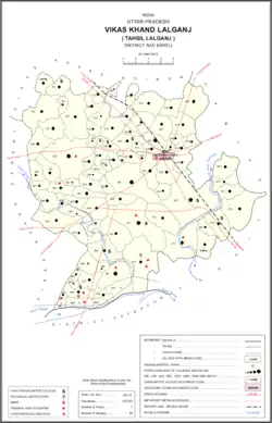 Map showing Sarai (#793) in Lalganj CD block | |
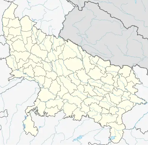 Sarai Location in Uttar Pradesh, India | |
| Coordinates: 26°12′10″N 80°53′54″E / 26.202845°N 80.898344°E[1] | |
| Country India | |
| State | Uttar Pradesh |
| District | Raebareli |
| Area | |
• Total | 0.776 km2 (0.300 sq mi) |
| Population (2011)[2] | |
• Total | 902 |
| • Density | 1,200/km2 (3,000/sq mi) |
| Languages | |
| • Official | Hindi |
| Time zone | UTC+5:30 (IST) |
| Vehicle registration | UP-35 |
Sarai is a village in Lalganj block of Rae Bareli district, Uttar Pradesh, India.[2] It is located 19 km from Lalganj, the block and tehsil headquarters.[3] As of 2011, it has a population of 902 people, in 173 households.[2] It has one primary school and no healthcare facilities.[2]
The 1961 census recorded Sarai as comprising 2 hamlets, with a total population of 483 people (233 male and 250 female), in 100 households and 90 physical houses.[4] The area of the village was given as 209 acres.[4] It was then part of Khiron block.[4]
The 1981 census recorded Sarai as having a population of 591 people, in 109 households, and having an area of 77.70 hectares.[3] The main staple foods were listed as wheat and rice.[3]
References
- ^ "Geonames Search". Do a radial search using these coordinates here.
- ^ a b c d e "Census of India 2011: Uttar Pradesh District Census Handbook - Rae Bareli, Part A (Village and Town Directory)" (PDF). Census 2011 India. pp. 288–306. Retrieved 16 August 2021.
- ^ a b c Census 1981 Uttar Pradesh: District Census Handbook Part XIII-A: Village & Town Directory, District Rae Bareli (PDF). 1982. pp. 150–1. Retrieved 16 August 2021.
- ^ a b c Census 1961: District Census Handbook, Uttar Pradesh (39 - Raebareli District) (PDF). Lucknow. 1965. pp. lxvi-lxvii of section "Dalmau Tahsil". Retrieved 14 August 2021.
{{cite book}}: CS1 maint: location missing publisher (link)