Lens-Lestang
Lens-Lestang | |
|---|---|
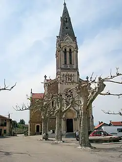 The church of Saint Jean-Baptiste, in Lens-Lestang | |
.svg.png) Coat of arms | |
Location of Lens-Lestang | |
 Lens-Lestang  Lens-Lestang | |
| Coordinates: 45°17′33″N 5°02′36″E / 45.2925°N 5.0433°E | |
| Country | France |
| Region | Auvergne-Rhône-Alpes |
| Department | Drôme |
| Arrondissement | Valence |
| Canton | Drôme des collines |
| Government | |
| • Mayor (2020–2026) | François Faure[1] |
Area 1 | 16.41 km2 (6.34 sq mi) |
| Population (2022)[2] | 885 |
| • Density | 54/km2 (140/sq mi) |
| Time zone | UTC+01:00 (CET) |
| • Summer (DST) | UTC+02:00 (CEST) |
| INSEE/Postal code | 26162 /26210 |
| Elevation | 237–448 m (778–1,470 ft) (avg. 300 m or 980 ft) |
| 1 French Land Register data, which excludes lakes, ponds, glaciers > 1 km2 (0.386 sq mi or 247 acres) and river estuaries. | |
Lens-Lestang (French pronunciation: [lɑ̃s lɛstɑ̃]) is a commune in the Drôme department in southeastern France.
Population
| Year | Pop. | ±% p.a. |
|---|---|---|
| 1968 | 655 | — |
| 1975 | 636 | −0.42% |
| 1982 | 672 | +0.79% |
| 1990 | 629 | −0.82% |
| 1999 | 667 | +0.65% |
| 2009 | 823 | +2.12% |
| 2014 | 814 | −0.22% |
| 2020 | 888 | +1.46% |
| Source: INSEE[3] | ||
See also
References
- ^ "Répertoire national des élus: les maires". data.gouv.fr, Plateforme ouverte des données publiques françaises (in French). 9 August 2021.
- ^ "Populations de référence 2022" (in French). The National Institute of Statistics and Economic Studies. 19 December 2024.
- ^ Population en historique depuis 1968, INSEE
Wikimedia Commons has media related to Lens-Lestang.