Manthes
Manthes | |
|---|---|
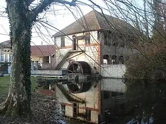 Mill | |
Location of Manthes | |
 Manthes  Manthes | |
| Coordinates: 45°18′13″N 5°00′29″E / 45.3036°N 5.0081°E | |
| Country | France |
| Region | Auvergne-Rhône-Alpes |
| Department | Drôme |
| Arrondissement | Valence |
| Canton | Drôme des collines |
| Government | |
| • Mayor (2020–2026) | Nathalie Durand[1] |
Area 1 | 6.83 km2 (2.64 sq mi) |
| Population (2022)[2] | 678 |
| • Density | 99/km2 (260/sq mi) |
| Time zone | UTC+01:00 (CET) |
| • Summer (DST) | UTC+02:00 (CEST) |
| INSEE/Postal code | 26172 /26210 |
| Elevation | 222–320 m (728–1,050 ft) (avg. 205 m or 673 ft) |
| 1 French Land Register data, which excludes lakes, ponds, glaciers > 1 km2 (0.386 sq mi or 247 acres) and river estuaries. | |
Manthes (French pronunciation: [mɑ̃t]) is a commune in the Drôme department in southeastern France.
Population
| Year | Pop. | ±% p.a. |
|---|---|---|
| 1968 | 572 | — |
| 1975 | 488 | −2.24% |
| 1982 | 502 | +0.40% |
| 1990 | 564 | +1.47% |
| 1999 | 570 | +0.12% |
| 2009 | 619 | +0.83% |
| 2014 | 669 | +1.57% |
| 2020 | 665 | −0.10% |
| Source: INSEE[3] | ||
See also
References
- ^ "Répertoire national des élus: les maires". data.gouv.fr, Plateforme ouverte des données publiques françaises (in French). 9 August 2021.
- ^ "Populations de référence 2022" (in French). The National Institute of Statistics and Economic Studies. 19 December 2024.
- ^ Population en historique depuis 1968, INSEE
Wikimedia Commons has media related to Manthes.