Lindetal
Lindetal | |
|---|---|
Location of Lindetal within Mecklenburgische Seenplatte district 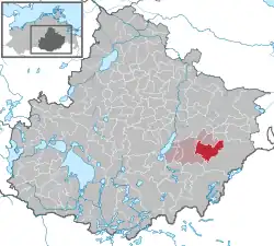 | |
 Lindetal 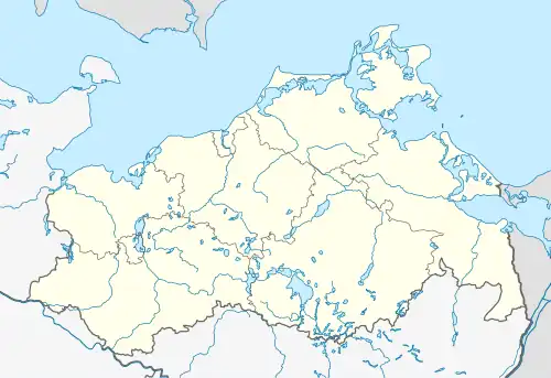 Lindetal | |
| Coordinates: 53°28′43″N 13°25′52″E / 53.47861°N 13.43111°E | |
| Country | Germany |
| State | Mecklenburg-Vorpommern |
| District | Mecklenburgische Seenplatte |
| Municipal assoc. | Stargarder Land |
| Subdivisions | 7 |
| Government | |
| • Mayor | Michael Scheidt |
| Area | |
• Total | 56.33 km2 (21.75 sq mi) |
| Elevation | 100 m (300 ft) |
| Population (2023-12-31)[1] | |
• Total | 1,155 |
| • Density | 21/km2 (53/sq mi) |
| Time zone | UTC+01:00 (CET) |
| • Summer (DST) | UTC+02:00 (CEST) |
| Postal codes | 17349 |
| Dialling codes | 03964, 03966 |
| Vehicle registration | MST |
| Website | www.burg-stargard.de |
Lindetal is a municipality in the district Mecklenburgische Seenplatte, in Mecklenburg-Vorpommern, Germany.
References