Lordat
Lordat | |
|---|---|
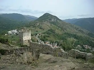 Castle and villages of Lordat | |
.svg.png) Coat of arms | |
Location of Lordat | |
 Lordat  Lordat | |
| Coordinates: 42°46′37″N 1°45′08″E / 42.7769°N 1.7522°E | |
| Country | France |
| Region | Occitania |
| Department | Ariège |
| Arrondissement | Foix |
| Canton | Haute-Ariège |
| Government | |
| • Mayor (2020–2026) | Christian Marcaillou[1] |
Area 1 | 7.37 km2 (2.85 sq mi) |
| Population (2022)[2] | 63 |
| • Density | 8.5/km2 (22/sq mi) |
| Time zone | UTC+01:00 (CET) |
| • Summer (DST) | UTC+02:00 (CEST) |
| INSEE/Postal code | 09171 /09250 |
| Elevation | 680–2,321 m (2,231–7,615 ft) (avg. 935 m or 3,068 ft) |
| 1 French Land Register data, which excludes lakes, ponds, glaciers > 1 km2 (0.386 sq mi or 247 acres) and river estuaries. | |
Lordat is a commune in the Ariège department in southwestern France.
Population
| Year | Pop. | ±% |
|---|---|---|
| 1962 | 44 | — |
| 1968 | 56 | +27.3% |
| 1975 | 54 | −3.6% |
| 1982 | 50 | −7.4% |
| 1990 | 41 | −18.0% |
| 1999 | 43 | +4.9% |
| 2008 | 35 | −18.6% |
See also
References
- ^ "Répertoire national des élus: les maires". data.gouv.fr, Plateforme ouverte des données publiques françaises (in French). 2 December 2020.
- ^ "Populations de référence 2022" (in French). The National Institute of Statistics and Economic Studies. 19 December 2024.
Wikimedia Commons has media related to Lordat.