Lot 2, Prince Edward Island
Lot 2, Prince Edward Island | |
|---|---|
Township | |
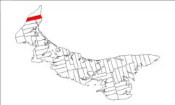 Map of Prince Edward Island highlighting Lot 2 | |
| Coordinates: 46°54′N 64°6′W / 46.900°N 64.100°W | |
| Country | Canada |
| Province | Prince Edward Island |
| County | Prince County |
| Parish | North Parish |
| Area | |
• Total | 85.84 km2 (33.14 sq mi) |
| Population (2006) | |
• Total | 1,655 |
| • Density | 19.3/km2 (50/sq mi) |
| Time zone | UTC-4 (AST) |
| • Summer (DST) | UTC-3 (ADT) |
| Canadian Postal code | C0B |
| Area code | 902 |
| NTS Map | 021I16 |
| GNBC Code | BAEQO |
Lot 2 is a township in Prince County, Prince Edward Island, Canada created during the 1764–1766 survey of Samuel Holland. It is part of North Parish.
Population
| Year | Pop. | ±% |
|---|---|---|
| 1871 | 1,343 | — |
| 1881 | 1,890 | +40.7% |
| 1891 | 2,282 | +20.7% |
| 1901 | 2,160 | −5.3% |
| 1911 | 1,992 | −7.8% |
| 1921 | 1,630 | −18.2% |
| 1931 | 1,406 | −13.7% |
| 1941 | 1,803 | +28.2% |
| 1996 | 1,766 | −2.1% |
| 2001 | 1,720 | −2.6% |
| 2006 | 1,655 | −3.8% |
| [1] | ||
Communities
Incorporated municipalities:
Civic address communities:
- Deblois
- Ebbsfleet
- Greenmount
- Harper
- Kildare Capes
- Leoville
- Palmer Road
- Pleasant View
- St. Edward
- St. Felix
- St. Lawrence
- St. Peter and St. Paul
- St. Roch
- Tignish Shore
- Woodvale
History
The township went through various owners under feudalism when Prince Edward Island was a British colony prior to Canadian Confederation:
- James Hunter and William Hunter, Merchants.[1] (1767–1810)
- John Hill [2] (1838)
- Sir Samuel Cunard.[3] (1864)
References
- ^ Dominion Bureau of Statistics (1944). Cudmore, S. A. (ed.). Eighth Census of Canada 1941 (Report). Vol. II: Population by Local Subdivisions. Edmond Cloutier, Printer to the King's Most Excellent Majesty. p. 55.
Subdivisions of Prince Edward Island | |||||||
|---|---|---|---|---|---|---|---|
| Subdivisions | |||||||
| Cities | |||||||
| Towns | |||||||
| Rural municipalities |
| ||||||
| Resort municipalities | |||||||
| Former municipalities |
| ||||||
| Unincorporated communities | |||||||
| Townships | |||||||
| |||||||