Lot 6, Prince Edward Island
Lot 6 | |
|---|---|
Township | |
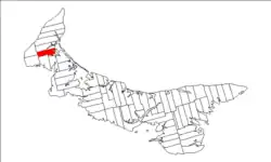 Map of Prince Edward Island highlighting Lot 6 | |
| Coordinates: 46°43′N 64°10′W / 46.717°N 64.167°W | |
| Country | Canada |
| Province | Prince Edward Island |
| County | Prince County |
| Parish | Egmont Parish |
| Area | |
• Total | 72.94 km2 (28.16 sq mi) |
| Population (2016) | |
• Total | 815 |
| • Density | 11.6/km2 (30/sq mi) |
| Time zone | UTC-4 (AST) |
| • Summer (DST) | UTC-3 (ADT) |
| Canadian Postal code | C0B |
| Area code | 902 |
| NTS Map | 021I09 |
| GNBC Code | BAEQS |
Lot 6 is a township in Prince County, Prince Edward Island, Canada. It is part of Egmont Parish. Lot 6 was awarded to William Crowle in the 1767 land lottery.[1]
Communities
Incorporated municipalities:
Civic address communities:
- Carleton
- Cascumpec
- Coleman
- Forestview
- Fortune Cove
- Howlan
- Knutsford
- Mount Royal
- O'Leary
- Roxbury
- Unionvale
- West Devon
- Woodstock
Demographics
| Year | Pop. | ±% |
|---|---|---|
| 1871 | 769 | — |
| 1881 | 1,100 | +43.0% |
| 1891 | 1,446 | +31.5% |
| 1901 | 1,322 | −8.6% |
| 1911 | 1,306 | −1.2% |
| 1921 | 1,257 | −3.8% |
| 1931 | 1,426 | +13.4% |
| 1941 | 1,510 | +5.9% |
| 2016 | 815 | −46.0% |
| [2] | ||
References
- ^ Clark, Andrew Hill (1959). Three Centuries and the Island. Toronto Press. pp. Appendix B.
- ^ Dominion Bureau of Statistics (1944). Cudmore, S. A. (ed.). Eighth Census of Canada 1941 (Report). Vol. II: Population by Local Subdivisions. Edmond Cloutier, Printer to the King's Most Excellent Majesty. p. 55.
Subdivisions of Prince Edward Island | |||||||
|---|---|---|---|---|---|---|---|
| Subdivisions | |||||||
| Cities | |||||||
| Towns | |||||||
| Rural municipalities |
| ||||||
| Resort municipalities | |||||||
| Former municipalities |
| ||||||
| Unincorporated communities | |||||||
| Townships | |||||||
| |||||||