Lusanger
Lusanger
| |
|---|---|
Commune | |
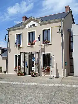 Town hall | |
.svg.png) Coat of arms | |
Location of Lusanger | |
 Lusanger  Lusanger | |
| Coordinates: 47°40′55″N 1°35′14″W / 47.6819°N 1.5872°W | |
| Country | France |
| Region | Pays de la Loire |
| Department | Loire-Atlantique |
| Arrondissement | Châteaubriant-Ancenis |
| Canton | Guémené-Penfao |
| Intercommunality | Châteaubriant-Derval |
| Government | |
| • Mayor (2020–2026) | Yves Fromentin[1] |
Area 1 | 35.38 km2 (13.66 sq mi) |
| Population (2022)[2] | 1,064 |
| • Density | 30/km2 (78/sq mi) |
| Time zone | UTC+01:00 (CET) |
| • Summer (DST) | UTC+02:00 (CEST) |
| INSEE/Postal code | 44086 /44590 |
| Elevation | 21–72 m (69–236 ft) |
| 1 French Land Register data, which excludes lakes, ponds, glaciers > 1 km2 (0.386 sq mi or 247 acres) and river estuaries. | |
Lusanger (French pronunciation: [lyzɑ̃ʒe]; Gallo: Lusanjae, Breton: Luzevieg) is a commune in the Loire-Atlantique department in western France.
Population
| Year | Pop. | ±% p.a. |
|---|---|---|
| 1968 | 1,020 | — |
| 1975 | 934 | −1.25% |
| 1982 | 914 | −0.31% |
| 1990 | 926 | +0.16% |
| 1999 | 947 | +0.25% |
| 2007 | 1,007 | +0.77% |
| 2012 | 1,023 | +0.32% |
| 2017 | 1,047 | +0.46% |
| Source: INSEE[3] | ||
See also
References
- ^ "Répertoire national des élus: les maires" (in French). data.gouv.fr, Plateforme ouverte des données publiques françaises. 13 September 2022.
- ^ "Populations de référence 2022" (in French). The National Institute of Statistics and Economic Studies. 19 December 2024.
- ^ Population en historique depuis 1968, INSEE
Wikimedia Commons has media related to Lusanger.