Saint-Herblain
Saint-Herblain
| |
|---|---|
Commune | |
 | |
.svg.png) Coat of arms | |
Location of Saint-Herblain | |
 Saint-Herblain  Saint-Herblain | |
| Coordinates: 47°12′44″N 1°38′59″W / 47.2122°N 1.6497°W | |
| Country | France |
| Region | Pays de la Loire |
| Department | Loire-Atlantique |
| Arrondissement | Nantes |
| Canton | Saint-Herblain-1 and 2 |
| Intercommunality | Nantes Métropole |
| Government | |
| • Mayor (2020–2026) | Bertrand Affilé[1] |
Area 1 | 30.02 km2 (11.59 sq mi) |
| Population (2022)[2] | 50,561 |
| • Density | 1,700/km2 (4,400/sq mi) |
| Time zone | UTC+01:00 (CET) |
| • Summer (DST) | UTC+02:00 (CEST) |
| INSEE/Postal code | 44162 /44800 |
| Elevation | 1–64 m (3.3–210.0 ft) |
| 1 French Land Register data, which excludes lakes, ponds, glaciers > 1 km2 (0.386 sq mi or 247 acres) and river estuaries. | |
Saint-Herblain (French pronunciation: [sɛ̃t‿ɛʁblɛ̃] ⓘ; Gallo: Saent-Erbelaen, Breton: Sant-Ervlan, pronounced [ˈsãnt ɛrvlãn]) is a commune in the Loire-Atlantique department, administrative region of Pays de la Loire, France.[3]
It is the largest suburb of the city of Nantes, and lies adjacent to its west side.
History
The commune is named after the 7th-century AD Saint Hermeland (French: Herblain and other names; Hermelandus in Breton and Latin), abbot and confessor under the Frankish king Chlothar III.
Population
|
| |||||||||||||||||||||||||||||||||||||||||||||||||||||||||||||||||||||||||||||||||||||||||||||||||||||||||||||||
| Source: EHESS[4] and INSEE (1968-2017)[5] | ||||||||||||||||||||||||||||||||||||||||||||||||||||||||||||||||||||||||||||||||||||||||||||||||||||||||||||||||
Breton language
In 2008, 0,36% of the children attended the bilingual schools in primary education. The school network in Breton Diwan has opened a college in Saint-Herblain, the first in the area.
Transport
The Gare de Basse-Indre-Saint-Herblain railway station is served by regional trains between Nantes and Saint-Nazaire.
Buildings and structures
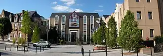
- The Hôtel de Ville was completed in 1938.[6]
- The telecommunications tower, which is 110 metres (360 ft) high, was built of concrete and completed in 2000.[7]
Twin towns - sister cities
Saint-Herblain is twinned with:[8]
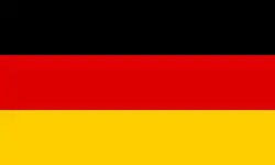 Sankt Ingbert, Germany, since 1981
 Waterford City, Ireland, since 1986 where a housing estate is named after the suburb, St Herblain Park
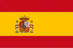 Viladecans, Spain, since 1991
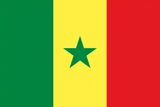 N’Diaganiao, Senegal
 Kazanlak, Bulgaria, since 2008
 Cleja, Romania
See also
References
- ^ "Répertoire national des élus: les maires" (in French). data.gouv.fr, Plateforme ouverte des données publiques françaises. 13 September 2022.
- ^ "Populations de référence 2022" (in French). The National Institute of Statistics and Economic Studies. 19 December 2024.
- ^ INSEE commune file
- ^ Des villages de Cassini aux communes d'aujourd'hui: Commune data sheet Saint-Herblain, EHESS (in French).
- ^ Population en historique depuis 1968, INSEE
- ^ "Patrimoine: regard sur l'Hôtel de Ville". Town of Saint-Herblain. Retrieved 31 May 2025.
- ^ "Tour hertzienne". Infraviewer. Archived from the original on 1 May 2022.
- ^ "Les relations internationales". saint-herblain.fr (in French). Saint-Herblain. Archived from the original on 3 August 2020. Retrieved 18 November 2019.
External links
- Official website (in French)