Lake Moels
| Lake Moels | |
|---|---|
| Mölssee (German) | |
 | |
 Lake Moels | |
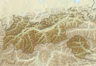
| Location | Tyrol, Austria |
| Coordinates | 47°10′24″N 11°36′35″E / 47.17333°N 11.60972°E |
| Primary outflows | Mölsbach |
| Basin countries | Austria |
| Max. length | c. 200 m (660 ft)[1] |
| Max. width | c. 55 m (180 ft)[1] |
| Surface area | 3.46 ha (9 acres) |
| Surface elevation | 2,240 m (7,349 ft)[1] |
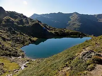
Lake Moels (German: Mölssee) is a lake of Tyrol, Austria.
It can be found at the upper part of the Wattental valley at a height of 2,240 metres.[1] With an area of 3.46 ha (8.5 acres), it is one of the larger lakes in the area.[1] The lake can be reached by following the road Wattentalstraße beginning in Wattens. Then above the Moels Alp the lake may be gained by walking up a pretty steep trail heading for the Moels col (Mölser Scharte). The mountain lake lies within a military training area, so it can be only visited at certain particular times.
Water temperature: 11–13 °C (52–55 °F)
Water quality
The crystal-clear, clean, mountain lake water has a very high drinking water quality and is a habitat for fish such as carp and trout.[1] The lake is very cold and, even in midsummer, temperatures of 16 °C (61 °F) are rarely reached.
Inflow and outflow
The Mölsbach is the natural outflow and drains the lake.[1]
References