Mare (river)
| Mare | |
|---|---|
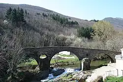 Bridge over the Mare at Andabre | |
  | |
| Native name | La Mare (French) |
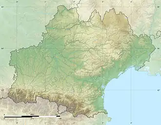
| Location | |
| Country | France |
| Physical characteristics | |
| Source | |
| • location | Massif Central |
| Mouth | |
• location | Orb |
• coordinates | 43°35′29″N 3°7′21″E / 43.59139°N 3.12250°E |
| Length | 29.5 km (18.3 mi) |
| Discharge | |
| • average | 4 m3/s (140 cu ft/s) |
| Basin features | |
| Progression | Orb→ Mediterranean Sea |
The Mare (French pronunciation: [maʁ] ⓘ) is a 29.5 km (18.3 mi) river in the Hérault department in southern France,[1] which rises in the Caroux-Espinouse hills.
The river's source is above Castanet-le-Haut in the Parc naturel régional du Haut-Languedoc. The river passes through Saint-Gervais-sur-Mare and Villemagne-l'Argentière, before joining the Orb at Hérépian.
Communes traversed
The river passes through the following communes, from source to mouth:
- Castanet-le-Haut
- Rosis
- Saint-Gervais-sur-Mare
- Saint-Étienne-Estréchoux
- La Tour-sur-Orb
- Bédarieux
- Taussac-la-Billière
- Villemagne-l'Argentière
- Hérépian
References
Wikimedia Commons has media related to Mare River.