Castanet-le-Haut
Castanet-le-Haut | |
|---|---|
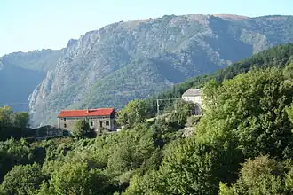
 The road into Castanet-le-Haut | |
.svg.png) Coat of arms | |
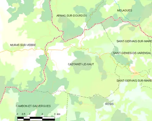
Location of Castanet-le-Haut | |
 Castanet-le-Haut  Castanet-le-Haut | |
| Coordinates: 43°40′07″N 2°58′21″E / 43.6686°N 2.9725°E | |
| Country | France |
| Region | Occitania |
| Department | Hérault |
| Arrondissement | Béziers |
| Canton | Saint-Pons-de-Thomières |
| Intercommunality | CC du Haut-Languedoc |
| Government | |
| • Mayor (2020–2026) | Max Allies[1] |
Area 1 | 27.55 km2 (10.64 sq mi) |
| Population (2022)[2] | 224 |
| • Density | 8.1/km2 (21/sq mi) |
| Time zone | UTC+01:00 (CET) |
| • Summer (DST) | UTC+02:00 (CEST) |
| INSEE/Postal code | 34055 /34610 |
| Elevation | 389–1,124 m (1,276–3,688 ft) (avg. 450 m or 1,480 ft) |
| 1 French Land Register data, which excludes lakes, ponds, glaciers > 1 km2 (0.386 sq mi or 247 acres) and river estuaries. | |
Castanet-le-Haut (French pronunciation: [kastanɛ lə o]; Occitan: Castanet lo Naut) is a commune in the Hérault department in southern France.
Geography
The commune is traversed by the rivers Dourdou de Camarès and Mare.
Population
| Year | Pop. | ±% p.a. |
|---|---|---|
| 1968 | 222 | — |
| 1975 | 188 | −2.35% |
| 1982 | 164 | −1.93% |
| 1990 | 148 | −1.27% |
| 1999 | 167 | +1.35% |
| 2009 | 187 | +1.14% |
| 2014 | 198 | +1.15% |
| 2020 | 218 | +1.62% |
| Source: INSEE[3] | ||
The residents are called Castanetais in French.
See also
References
- ^ "Répertoire national des élus: les maires". data.gouv.fr, Plateforme ouverte des données publiques françaises (in French). 2 December 2020.
- ^ "Populations de référence 2022" (in French). The National Institute of Statistics and Economic Studies. 19 December 2024.
- ^ Population en historique depuis 1968, INSEE
Wikimedia Commons has media related to Castanet-le-Haut.