Miary
Miary | |
|---|---|
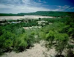 Fiherenana River at Miary | |
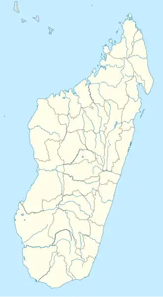 Miary Location in Madagascar | |
| Coordinates: 23°18′S 43°44′E / 23.300°S 43.733°E | |
| Country | |
| Region | Atsimo-Andrefana |
| District | Toliara II |
| Area | |
• Total | 140 km2 (50 sq mi) |
| Elevation | 34 m (112 ft) |
| Population (2008)[3] | |
• Total | 12,500 |
| • Ethnicities | Masikoro (90%) |
| Time zone | UTC3 (EAT) |
| Postal code | 602 |
Miary is a rural municipality in Madagascar. It belongs to the district of Toliara II, which is a part of Atsimo-Andrefana Region. The population of the municipality was estimated to be approximately 12500 in 2008[3] of which 90% are Masikoro. The municipality has 11 fokontany (villages).
Primary and junior level secondary education are available in town. The rate of scolarization in Miary had been 70% in 2007.[4] Farming and raising livestock provides employment for 40% and 40% of the working population. The most important crops are cotton and cassava, while other important agricultural products are sugarcane and maize. Services provide employment for 20% of the population.[3]
Miary has a health center Type II (CSB II).
Geography
Miary lies on the left banks of the lower Fiherenana River, 10 km North-East of Tulear.
Sights
Miary is famous its sacred tree (L'arbre de Miary), a banyan which is said to be 1,700 years old.[5] It is in the eastern part of the village close to the Market Place. On the Market Place opposite the Town hall (Mairie), a market hall and an independence memorial can be visited.
-
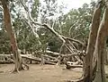 L'arbre de Miary
 -
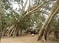 L'arbre de miary
 -
 Town hall
 -
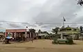 Market Place
 -
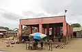 Market hall
References
- ^ LES STRATEGIES PAYSANNES DE DEVELOPPEMENT LES STRATEGIES PAYSANNES DE DEVELOPPEMENT DANS LA COMMUNE RURALE DE MIARY
- ^ Estimated based on DEM data from Shuttle Radar Topography Mission
- ^ a b c "ILO census data". Cornell University. 2002. Retrieved 2008-03-13.
- ^ Analyse écogéographique de la végétation sectorielle du Fiherenana - Nourddine MIRHANI, 2007. Université de Toliara
- ^ Heiko Hooge: Madagaskar, p. 110. Ostfildern 2023
Capital: Toliara | ||
| Ampanihy Ouest (19) - 605 | 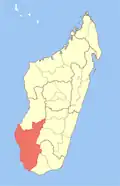 | |
| Ankazoabo - 606 - (10) |
| |
| Benenitra - 610 - (6) |
| |
| Beroroha - 611 - (9) |
| |
| Betioky-Atsimo -612 - (31) |
| |
| Morombe (9) - 618 | ||
| Sakaraha (12) - 620 | ||
| Toliara I (1) | ||
| Toliara II (22) (602) | ||
9 districts; 119 communes | ||
23°18′S 43°44′E / 23.300°S 43.733°E