Montgermont
Montgermont
| |
|---|---|
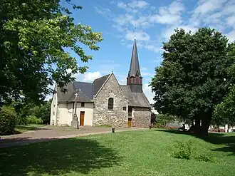 The church of Montgermont | |
.svg.png) Coat of arms | |
Location of Montgermont | |
 Montgermont  Montgermont | |
| Coordinates: 48°09′27″N 1°42′54″W / 48.1575°N 1.7150°W | |
| Country | France |
| Region | Brittany |
| Department | Ille-et-Vilaine |
| Arrondissement | Rennes |
| Canton | Betton |
| Intercommunality | Rennes Métropole |
| Government | |
| • Mayor (2020–2026) | Laurent Prize[1] |
Area 1 | 4.67 km2 (1.80 sq mi) |
| Population (2022)[2] | 3,777 |
| • Density | 810/km2 (2,100/sq mi) |
| Time zone | UTC+01:00 (CET) |
| • Summer (DST) | UTC+02:00 (CEST) |
| INSEE/Postal code | 35189 /35760 |
| Elevation | 34–62 m (112–203 ft) |
| 1 French Land Register data, which excludes lakes, ponds, glaciers > 1 km2 (0.386 sq mi or 247 acres) and river estuaries. | |
Montgermont (French pronunciation: [mɔ̃ʒɛʁmɔ̃]; Breton: Menezgervant, Gallo: Monjèrmont) is a commune in the Ille-et-Vilaine department of Brittany in northwestern France.
Population
Inhabitants of Montgermont are called in French Montgermontais.
| Year | Pop. | ±% p.a. |
|---|---|---|
| 1968 | 606 | — |
| 1975 | 1,099 | +8.88% |
| 1982 | 1,976 | +8.74% |
| 1990 | 2,395 | +2.43% |
| 1999 | 2,758 | +1.58% |
| 2007 | 3,085 | +1.41% |
| 2012 | 3,218 | +0.85% |
| 2017 | 3,364 | +0.89% |
| Source: INSEE[3] | ||
See also
References
- ^ "Répertoire national des élus: les maires". data.gouv.fr, Plateforme ouverte des données publiques françaises (in French). 9 August 2021.
- ^ "Populations de référence 2022" (in French). The National Institute of Statistics and Economic Studies. 19 December 2024.
- ^ Population en historique depuis 1968, INSEE
External links
Wikimedia Commons has media related to Montgermont.
- Official website (in French)
- Base Mérimée: Search for heritage in the commune, Ministère français de la Culture. (in French)
- Mayors of Ille-et-Vilaine Association (in French)