Mortagne-sur-Sèvre
Mortagne-sur-Sèvre | |
|---|---|
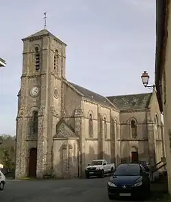 The church in the village of Evrunes, in Mortagne-sur-Sèvre | |
 Coat of arms | |
Location of Mortagne-sur-Sèvre | |
 Mortagne-sur-Sèvre  Mortagne-sur-Sèvre | |
| Coordinates: 46°59′33″N 0°57′09″W / 46.9925°N 0.9525°W | |
| Country | France |
| Region | Pays de la Loire |
| Department | Vendée |
| Arrondissement | La Roche-sur-Yon |
| Canton | Mortagne-sur-Sèvre |
| Intercommunality | Pays de Mortagne |
| Government | |
| • Mayor (2020–2026) | Alain Brochoire[1] |
Area 1 | 21.94 km2 (8.47 sq mi) |
| Population (2022)[2] | 6,065 |
| • Density | 280/km2 (720/sq mi) |
| Time zone | UTC+01:00 (CET) |
| • Summer (DST) | UTC+02:00 (CEST) |
| INSEE/Postal code | 85151 /85290 |
| Elevation | 57–151 m (187–495 ft) |
| 1 French Land Register data, which excludes lakes, ponds, glaciers > 1 km2 (0.386 sq mi or 247 acres) and river estuaries. | |
Mortagne-sur-Sèvre (French pronunciation: [mɔʁtaɲ syʁ sɛvʁ], literally Mortagne on Sèvre) is a commune in the Vendée department in the Pays de la Loire region in western France. The commune was formed by the consolidation Mortagne-sur-Sèvre, Évrunes and Saint-Hilaire-de-Mortagne in 1964.
Population
| Year | Pop. | ±% p.a. |
|---|---|---|
| 1968 | 4,246 | — |
| 1975 | 4,691 | +1.43% |
| 1982 | 5,301 | +1.76% |
| 1990 | 5,724 | +0.96% |
| 1999 | 5,938 | +0.41% |
| 2007 | 6,080 | +0.30% |
| 2012 | 5,992 | −0.29% |
| 2017 | 5,930 | −0.21% |
| Source: INSEE[3] | ||
See also
References
- ^ "Répertoire national des élus: les maires". data.gouv.fr, Plateforme ouverte des données publiques françaises (in French). 2 December 2020.
- ^ "Populations de référence 2022" (in French). The National Institute of Statistics and Economic Studies. 19 December 2024.
- ^ Population en historique depuis 1968, INSEE
Wikimedia Commons has media related to Mortagne-sur-Sèvre.