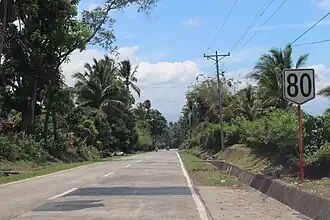
The Molave–Dipolog Road, also known as theMalindang Mountain Road, is an 82-kilometer (51 mi), two-to-four lane, primary national road that connects the provinces of Zamboanga del Norte[1][2] and Zamboanga del Sur.[3] This road serves as the main highway when going to Dipolog from Pagadian.
The entire highway is designated as National Route 80 (N80) of the Philippine highway network.
References
|
|---|
| National primary roads |
| |
|---|
| National secondary roads | | Luzon | |
|---|
| Visayas | |
|---|
| Mindanao |
- N870
- N871
- N872
- N873
- N874
- N875
- N876
- N877
- N878
- N879
- N880
- N881
- N890
- N891
- N900
- N901
- N902
- N903
- N904
- N905
- N906
- N907
- N908
- N909
- N910
- N911
- N912
- N913
- N914
- N915
- N916
- N917
- N918
- N919
- N920
- N921
- N922
- N923
- N924
- N926
- N930
- N931
- N932
- N933
- N935
- N936
- N937
- N939
- N940
- N941
- N942
- N943
- N944
- N945
- N946
- N947
- N948
- N949
- N950
- N951
- N952
- N953
- N954
- N955
- N956
- N957
- N958
- N959
- N960
- N961
- N962
- N963
- N964
- N965
- N966
- N968
- N969
- N970
- N980
- N981
- N982
- N985
- N986
- N987
- N988
- N989
- N990
- N991
- N992
|
|---|
|
|---|
|
|
|---|
| Government | |
|---|
| Road | |
|---|
| Rail | |
|---|
| Water | |
|---|
| Aviation | |
|---|
| Payment | |
|---|
| Intermodal terminals | |
|---|
| Related articles | |
|---|
Italics indicate defunct, proposed, or under construction. |
.svg.png)