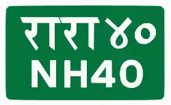
National Highway NH40 (Thanapati-Samakhushi) is a national highway of Nepal. The highway is located in Kathmandu District and Nuwakot District of Bagmati Province. The total length of the highway is 29.52 kilometres (18.34 mi). [1] [2]
The Highway was proposed to construct
54.80 kilometres (34.05 mi) as a Feeder road (F082) from Samakhushi to Gangate [3] but later plan changed and took decision to convert 29.52 kilometres (18.34 mi) of the road from Samakhushi to Thanagau as National Highway 40. The government gave a contract to upgrade and develop the Feeder road F082 (from Samakhusi to Thanagau 29.52 kilometres (18.34 mi)) plus (Thanagau to Chhahare 4.62 kilometres (2.87 mi)) total 34.2 kilometres (21.3 mi).[4] The project was envisioned to increase trade between Kerung bazaar and China through Rasuwa and Nuwakot[5]
References
External links
|
|---|
| Highways | | East–west highways | |
|---|
| North–south highways | |
|---|
| Corridors | |
|---|
| Mid-hill to south | |
|---|
| Mid-hill to north | |
|---|
| Hill to hill | |
|---|
| Minor highways | |
|---|
| |
|---|
| Expressway | |
|---|
| Ring roads | |
|---|
| Provincial highways |
- Koshi
- Madhesh
- Bagmati
- Lumbini
- Gandaki
- Karnali
- Sudurpashchim
|
|---|