National Highway 50 (Nepal)
 | ||||
|---|---|---|---|---|
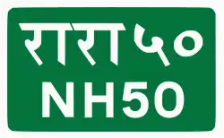
| राष्ट्रिय राजमार्ग ५० | ||||
| Maryadpur-Taulihwa-Jitpur | ||||
NH50 in red | ||||
| Route information | ||||
| Maintained by MoPIT (Department of Roads) | ||||
| Length | 33.05 km (20.54 mi) | |||
| Major junctions | ||||
| North end | Jitpur | |||
| Taulihawa | ||||
| Sourh end | Maryadpur | |||
| Location | ||||
| Country | Nepal | |||
| Provinces | Lumbini Province | |||
| Districts | Kapilvastu District | |||
| Highway system | ||||
| ||||
National Highway 50, NH50 (Maryadpur–Taulihawa–Jitpur) is a national highway in Nepal. The highway is located in Kapilvastu District in Lumbini Province.[1] The total length of the highway is 33.05 kilometres (20.54 mi). [2] [3] It was a Feeder Road F010[4] which upgrade to NH50.
The road starts at Maryadpur (Indo-Nepal) border connects the district headquarters at Taulihawa and runs north-east to connect with Mahendra Highway (NH01) at Jitpur.[5][6]
References
- ^ "Upgrading and improving of Jitpur-Taulihawa-Khunuwa NH50 road". J360. 2024. Retrieved 19 Jul 2024.
- ^ "Statics of National Highway 2020_21" (PDF). Nepal in data. Department of Roads (Nepal). 2021-09-22. Retrieved 2024-06-18.
- ^ "Statics of Strategic Road Network". Department of Roads (Nepal). 2023. Retrieved 2024-06-18.
- ^ "Existing Highway and Proposed Extension". DOR. Retrieved 18 Jul 2024.
- ^ "मर्यादपुर बाडर" [Maryadpur Border] (in Nepali). Himalkhabar=. 21 Jul 2018. Retrieved 19 Jul 2024.
- ^ "जीतपुर तौलिहवा सडकको स्तरोन्नती कार्य सुरु" [Upgradation of Jeetpur Taulihawa road started] (in Nepali). Thahakhabar. 20 Jan 2017. Retrieved 19 Jul 2024.
External links
| Highways |
| |||||||||||||||
|---|---|---|---|---|---|---|---|---|---|---|---|---|---|---|---|---|
| Expressway | ||||||||||||||||
| Ring roads | ||||||||||||||||
| Provincial highways |
| |||||||||||||||