Oberlauterbach
Oberlauterbach | |
|---|---|
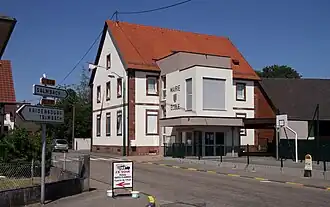 Townhall and school | |
.svg.png) Coat of arms | |
Location of Oberlauterbach | |
 Oberlauterbach  Oberlauterbach | |
| Coordinates: 48°57′00″N 8°04′14″E / 48.95°N 8.0706°E | |
| Country | France |
| Region | Grand Est |
| Department | Bas-Rhin |
| Arrondissement | Haguenau-Wissembourg |
| Canton | Wissembourg |
| Intercommunality | Plaine du Rhin |
| Government | |
| • Mayor (2020–2026) | Bruno Kraemer[1] |
Area 1 | 5.32 km2 (2.05 sq mi) |
| Population (2022)[2] | 549 |
| • Density | 100/km2 (270/sq mi) |
| Time zone | UTC+01:00 (CET) |
| • Summer (DST) | UTC+02:00 (CEST) |
| INSEE/Postal code | 67346 /67160 |
| Elevation | 148–192 m (486–630 ft) |
| 1 French Land Register data, which excludes lakes, ponds, glaciers > 1 km2 (0.386 sq mi or 247 acres) and river estuaries. | |
Oberlauterbach is a commune in the Bas-Rhin department in Grand Est in north-eastern France.[3]
Population
| Year | Pop. | ±% p.a. |
|---|---|---|
| 1968 | 350 | — |
| 1975 | 340 | −0.41% |
| 1982 | 343 | +0.13% |
| 1990 | 396 | +1.81% |
| 1999 | 459 | +1.65% |
| 2007 | 520 | +1.57% |
| 2012 | 536 | +0.61% |
| 2017 | 540 | +0.15% |
| Source: INSEE[4] | ||
See also
References
- ^ "Répertoire national des élus: les maires". data.gouv.fr, Plateforme ouverte des données publiques françaises (in French). 2 December 2020.
- ^ "Populations de référence 2022" (in French). The National Institute of Statistics and Economic Studies. 19 December 2024.
- ^ INSEE commune file
- ^ Population en historique depuis 1968, INSEE
Wikimedia Commons has media related to Oberlauterbach.