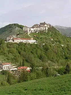
Opi, Abruzzo
Opi | |
|---|---|
| Comune di Opi | |
 | |
 Coat of arms | |
Location of Opi | |
 Opi Location of Opi in Italy 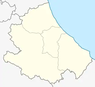 Opi Opi (Abruzzo) | |
| Coordinates: 41°46′40″N 13°49′48″E / 41.77778°N 13.83000°E | |
| Country | Italy |
| Region | Abruzzo |
| Province | L'Aquila (AQ) |
| Government | |
| • Mayor | Berardino Antonio Paglia |
| Area | |
• Total | 49.91 km2 (19.27 sq mi) |
| Elevation | 1,250 m (4,100 ft) |
| Population (28 February 2017)[2] | |
• Total | 408 |
| • Density | 8.2/km2 (21/sq mi) |
| Demonym | Opiani |
| Time zone | UTC+1 (CET) |
| • Summer (DST) | UTC+2 (CEST) |
| Postal code | 67030 |
| Dialing code | 0863 |
| Saint day | June 24 |
| Website | Official website |
Opi (Marsicano: Opjë [ˈoːpjə]) is a comune and town in the province of L'Aquila in the Abruzzo region of central Italy. It is located in the National Park of Abruzzo, Lazio e Molise. It is one of I Borghi più belli d'Italia ("The most beautiful villages of Italy").[3]
Main sights
- Mother Church of Santa Maria Assunta (mid-12th century)
- Church of San Giovanni Battista (late 17th century)
- Necropolis of Val Fondillo
References
- ^ "Superficie di Comuni Province e Regioni italiane al 9 ottobre 2011". Italian National Institute of Statistics. Retrieved 16 March 2019.
- ^ "Popolazione Residente al 1° Gennaio 2018". Italian National Institute of Statistics. Retrieved 16 March 2019.
- ^ "Abruzzo" (in Italian). Retrieved 1 August 2023.