Předslav
Předslav | |
|---|---|
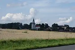 General view | |
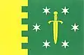 Flag 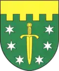 Coat of arms | |
 Předslav Location in the Czech Republic | |
| Coordinates: 49°26′51″N 13°21′16″E / 49.44750°N 13.35444°E | |
| Country | |
| Region | Plzeň |
| District | Klatovy |
| First mentioned | 1352 |
| Area | |
• Total | 19.60 km2 (7.57 sq mi) |
| Elevation | 420 m (1,380 ft) |
| Population (2025-01-01)[1] | |
• Total | 826 |
| • Density | 42/km2 (110/sq mi) |
| Time zone | UTC+1 (CET) |
| • Summer (DST) | UTC+2 (CEST) |
| Postal codes | 339 01 |
| Website | www |
Předslav is a municipality and village in Klatovy District in the Plzeň Region of the Czech Republic. It has about 800 inhabitants.
Předslav lies approximately 8 kilometres (5 mi) north-east of Klatovy, 34 km (21 mi) south of Plzeň, and 105 km (65 mi) south-west of Prague.
Administrative division
Předslav consists of seven municipal parts (in brackets population according to the 2021 census):[2]
- Předslav (316)
- Hůrka (11)
- Makov (112)
- Měcholupy (155)
- Němčice (118)
- Petrovičky (73)
- Třebíšov (21)
Demographics
| Year | Pop. | ±% |
|---|---|---|
| 1869 | 1,831 | — |
| 1880 | 2,000 | +9.2% |
| 1890 | 1,918 | −4.1% |
| 1900 | 1,811 | −5.6% |
| 1910 | 1,735 | −4.2% |
| 1921 | 1,783 | +2.8% |
| 1930 | 1,511 | −15.3% |
| 1950 | 1,134 | −25.0% |
| 1961 | 1,179 | +4.0% |
| 1970 | 990 | −16.0% |
| 1980 | 900 | −9.1% |
| 1991 | 763 | −15.2% |
| 2001 | 698 | −8.5% |
| 2011 | 731 | +4.7% |
| 2021 | 806 | +10.3% |
| Source: Censuses[3][4] | ||
References
- ^ "Population of Municipalities – 1 January 2025". Czech Statistical Office. 2025-05-16.
- ^ "Public Census 2021 – basic data". Public Database (in Czech). Czech Statistical Office. 2022.
- ^ "Historický lexikon obcí České republiky 1869–2011" (in Czech). Czech Statistical Office. 2015-12-21.
- ^ "Population Census 2021: Population by sex". Public Database. Czech Statistical Office. 2021-03-27.
External links
Wikimedia Commons has media related to Předslav.