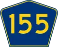
Puerto Rico Highway 155
  Highway 155 | ||||
|---|---|---|---|---|
| Ruta 155 | ||||
| Route information | ||||
| Maintained by Puerto Rico DTPW | ||||
| Length | 69.0 km[1] (42.9 mi) | |||
| Existed | 1953[2]–present | |||
| Major junctions | ||||
| South end | ||||
| ||||
| North end | ||||
| Location | ||||
| Country | United States | |||
| Territory | Puerto Rico | |||
| Municipalities | Coamo, Orocovis, Morovis, Vega Baja | |||
| Highway system | ||||
| ||||
| ||||
Puerto Rico Highway 155 (PR-155) is a rural road that goes from Coamo, Puerto Rico to Vega Baja through Orocovis and Morovis.[3] It extends from PR-14 in downtown Coamo to PR-2 east of downtown Vega Baja.[4]
-
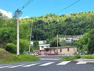
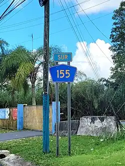 Puerto Rico Highway 155 south in Orocovis
 -
![Damián Arriba Fault (from PR-155 looking southwest)[5]](./_assets_/Damian_Arriba%252C_Orocovis%252C_Puerto_Rico.png) Damián Arriba Fault (from PR-155 looking southwest)[5]
Damián Arriba Fault (from PR-155 looking southwest)[5]
Major intersections
-
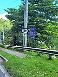 PR-155 south at its junction with PR-5555 east in Orocovis
 -
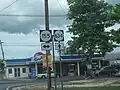
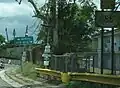 Puerto Rico Highway 155 in Morovis
 -
 PR-155 and PR-634 signs in Morovis
| Municipality | Location | km[1] | mi | Destinations | Notes |
|---|---|---|---|---|---|
| Coamo | Coamo barrio-pueblo | 0.0 | 0.0 | Southern terminus of PR-155; one-way street; eastbound access via Calle Florencio Santiago | |
| Pasto | 2.3 | 1.4 | |||
| 4.6 | 2.9 | ||||
| 5.8 | 3.6 | ||||
| Coamo–Orocovis municipal line | Hayales–Bauta Arriba– Bermejales tripoint | 16.1 | 10.0 | ||
| Orocovis | Saltos | 22.1 | 13.7 | ||
| Orocovis–Orocovis barrio-pueblo line | 27.4 | 17.0 | |||
| 27.5 | 17.1 | ||||
| Orocovis | 28.2 | 17.5 | |||
| 28.6 | 17.8 | ||||
| 30.3 | 18.8 | ||||
| Morovis | Río Grande–Morovis Sud line | 44.0 | 27.3 | ||
| Morovis Sud | 46.2 | 28.7 | |||
| Monte Llano | 46.6 | 29.0 | |||
| Morovis barrio-pueblo | 47.1 | 29.3 | One-way streets | ||
| Morovis Norte | 47.5 | 29.5 | |||
| 48.2 | 30.0 | ||||
| 50.5 | 31.4 | ||||
| Morovis Norte–Torrecillas– Fránquez tripoint | 50.7 | 31.5 | |||
| Barahona | 53.8 | 33.4 | |||
| Fránquez | 55.3 8.7[a] | 34.4 5.4 | Southern terminus of PR-137 concurrency | ||
| Barahona | 8.5[a] 55.4 | 5.3 34.4 | Northern terminus of PR-137 concurrency | ||
| Barahona–Fránquez line | 55.5 | 34.5 | |||
| Vega Baja | Pugnado Adentro | 57.5 | 35.7 | ||
| Quebrada Arenas | 58.7 | 36.5 | |||
| Pugnado Afuera | 60.5 | 37.6 | |||
| 61.8 | 38.4 | ||||
| Algarrobo–Pugnado Afuera line | 64.8 | 40.3 | |||
| Algarrobo | 66.0 | 41.0 | |||
| 66.8 | 41.5 | ||||
| Cabo Caribe–Río Abajo line | 68.3 | 42.4 | |||
| Cabo Caribe | 69.0 | 42.9 | Northern terminus of PR-155 | ||
1.000 mi = 1.609 km; 1.000 km = 0.621 mi
| |||||
Related route
Highway 5155 | |
|---|---|
| Location | Orocovis |
| Length | 1.3 km[6] (0.81 mi) |
Puerto Rico Highway 5155 (PR-5155) is a north–south road that connects PR-155 with downtown Orocovis. This highways extends from PR-155 south near PR-5156 until its end at PR-5555 near PR-155 north.[7] The entire route is located in Orocovis.
-
 PR-5155 south at its junction with PR-5555 in Orocovis barrio
| Location | km[6] | mi | Destinations | Notes | |
|---|---|---|---|---|---|
| Orocovis–Orocovis barrio-pueblo line | 0.0 | 0.0 | Southern terminus of PR-5155 | ||
| Orocovis barrio-pueblo | 0.2– 0.3 | 0.12– 0.19 | |||
| Orocovis barrio-pueblo–Orocovis line | 0.6 | 0.37 | One-way street; PR-156 east access (to Barranquitas) is via Calle Luis Muñoz Rivera | ||
| 0.7– 0.8 | 0.43– 0.50 | ||||
| Orocovis | 1.3 | 0.81 | Northern terminus of PR-5155 | ||
| 1.000 mi = 1.609 km; 1.000 km = 0.621 mi | |||||
See also
References
- ^ a b "PR-155" (Map). Google Maps. Retrieved 26 March 2020.
- ^ "Morovis, Memoria Núm. 65" (PDF). Puerto Rico Planning Board (in Spanish). 1955. Retrieved 4 August 2020.
- ^ National Geographic Maps (2011). Puerto Rico (Map). 1:125,000. Adventure Map (Book 3107). Evergreen, Colorado: National Geographic Maps. ISBN 978-1566955188. OCLC 756511572.
- ^ "Tránsito Promedio Diario (AADT)". Transit Data (Datos de Transito) (in Spanish). DTOP PR. pp. 83–84. Archived from the original on 1 April 2019.
- ^ Geological Survey (U.S.) (1949). Geological Survey Bulletin 1184. Geological Survey Bulletin. U.S. Department of the Interior. p. 103. Retrieved 24 July 2021.
- ^ a b "PR-5155" (Map). Google Maps. Retrieved 6 April 2023.
- ^ "Mapa de Plan Vial de Orocovis" (PDF). Junta de Planificación (in Spanish). Retrieved 6 April 2023.
External links
Wikimedia Commons has media related to Puerto Rico Highway 155 and Puerto Rico Highway 5155.