Podolany, Poznań
Podolany | |
|---|---|
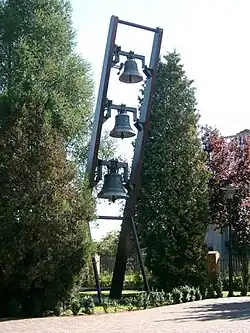 Bells at Podolany church | |
| Coordinates: 52°27′25″N 16°53′10″E / 52.45694°N 16.88611°E | |
| Country | Poland |
| Voivodeship | Greater Poland |
| City | Poznań |
| City district | Jeżyce |
| First appearance on map | 1798 |
| Incorporated into city limits | 1933 |
| Area | |
• Total | 5.3 km2 (2.0 sq mi) |
| Elevation | 85 m (279 ft) |
| Population (2012) | |
• Total | 7,203 |
| • Density | 1,359.06/km2 (3,519.9/sq mi) |
| Time zone | UTC+1 (CET) |
| • Summer (DST) | UTC+2 (CEST) |
| Postal code | 60-XXX |
| Telephone code | (+48) 61 |
| Vehicle registration | PO |
| SIMC | 0969652 |
| Website | www |
Podolany ([pɔdɔˈlanɨ]; German: Schoenherrnhausen) is a suburban neighbourhood of the city of Poznań in western Poland, located in the north-west of the city.
Podolany was incorporated into the city partly in 1933, and partly under German occupation in 1940–42. It is mainly a residential district, but its southern parts contain industrial sites.
Podolany is one of the 42 osiedles into which Poznań is divided (see Administrative division of Poznań). It is a part of the former wider district of Jeżyce.
Podolany is bounded to the west by the main railway line running northwards towards Piła. In the north-west corner of the district is the station Poznań Strzeszyn (named after Strzeszyn, a neighbourhood further to the west). Podolany is also served by a number of bus routes connecting it with the city centre.
| Administrative division |
|  | |||||||||||||||||||
|---|---|---|---|---|---|---|---|---|---|---|---|---|---|---|---|---|---|---|---|---|---|
| Attractions |
| ||||||||||||||||||||
| Education |
| ||||||||||||||||||||
| Culture |
| ||||||||||||||||||||
| Sports |
| ||||||||||||||||||||
| Transport |
| ||||||||||||||||||||
| Business | |||||||||||||||||||||
| History of Poznań | |||||||||||||||||||||
| |||||||||||||||||||||